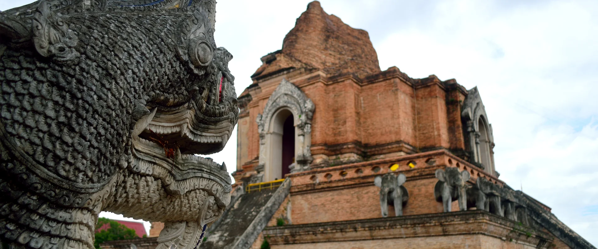
The brick stupa and naga stairway at Wat Chedi Luang in Chiang Mai Old City.
This guide provides general information from reviewed sources. Requirements can change and individual circumstances vary. Check the latest official requirements before acting.
Quick answer
Pick a base and one area per day
Walk the city centre and choose separate day trips for different mountain roads. Use each listing to confirm its exact entrance and visitor arrangements.
Inside the Old City moatTemple grounds, museums and walks between the gates
Chang Moi, Wat Ket and the city’s southMarket halls, craft heritage and neighbourhood stops
Doi Suthep, Suthep and the westHill temples, forest and university-side stops
Browse by area
Choose the option that best matches your situation to see the most relevant part of this guide.
Start with the Old City and the Ping if this is your first visit. Choose a separate day for the western mountain road, Mae Rim or Doi Inthanon. The 100 places below are grouped by the part of the province you can visit together, with a link to the exact market, trailhead, museum or landmark.
For city visits, save the gate, street entrance or riverbank that matches your route. For outlying stops, confirm your return transport before setting out. If you hire a driver, give them your furthest stop, opening window and pickup time when arranging the trip.
Check trail and waterfall notices on the day. Build mountain routes around daylight, visibility and separate park entrances. Bring an extra layer for high elevations and choose a town museum, workshop or market when travel conditions affect the hills.
1
Four ways to plan a day
1
Old City temple walk
1.Wat Phra Singh Start from the west end of Ratchadamnoen Road and give yourself time for the temple grounds.
2.Wat Chedi Luang Continue to Prapokklao Road and visit the brick chedi precinct.
3.Tha Phae Gate Finish at the east side of the moat, or return that evening if the Sunday market is on.
2
Market morning along the Ping
1.Warorot Market Start at Kad Luang. Save the market hall location before walking between the shopping streets.
2.Wat Ket Subdistrict Cross towards the east bank for the riverside neighbourhood. Check the specific bridge and destination pin before crossing.
3
Doi Suthep and the foothills
1.Wat Phra That Doi Suthep Use the mountain road and choose the stairs or the incline lift from the temple entrance area.
2.Wat Umong Allow a separate transfer down to the foothills for the forest temple and tunnels.
4
A Doi Inthanon trail day
1.Doi Inthanon National Park Confirm the route and conditions at the park before setting off up the mountain.
2.Kew Mae Pan Nature Trail Check the day’s access and arrange the local guide at the trail station when the seasonal route is open.
3.Ang Ka Luang Nature Trail Allow time at the summit area for the boardwalk if it is open, or choose it as your main short walk.
2
Four outings beyond the city
1
Mae Sa valley
1.Queen Sirikit Botanic Garden Start with the glasshouse or canopy area and check the garden’s admission notice.
2.Mae Sa Waterfall Use the separate Route 1096 turnoff for the shaded lower cascades if daylight and trail conditions allow.
2
Mae On village and waterfall
1.Mae Kampong Village Ask your host or driver about parking and pickup before walking up the main lane.
2.Mae Kampong Waterfall Continue up to the signed approach when the steps are dry enough for your group.
3
Chiang Dao without a summit permit
1.Chiang Dao Cave Ask which chambers are open and whether your group wants a local guide for the unlit passages.
2.Wat Tham Pha Plong Continue by local road to the monastery staircase if your group is comfortable with steps.
2.Wat Tha Ton Royal Temple Visit the Kok River terraces on a separate road leg towards Mae Ai and leave daylight for the return.
3
What to arrange before setting out
Reserve workshops and homestays with their hosts. Confirm pickup and return arrangements for a remote valley or trailhead. For current mountain and waterfall conditions, check with the park on your travel day.
Kew Mae Pan uses a local guide and has seasonal access.
Doi Luang Chiang Dao has its own permission and overnight quota through the wildlife sanctuary. Check the current permit process before building a trip around the summit.
Bo Sang Umbrella Making Centre takes advance enquiries about painting an umbrella. Ask which sessions will run before planning a craft afternoon.
Elephant Nature Park lists prebooked observation programmes in Mae Taeng. Check the programme, pickup and visit conditions before arranging a separate trip.
4
Chiang Mai Old City
Choose a walking loop with one anchor temple and one museum. Check each museum’s opening day, and follow visitor notices during temple ceremonies.
1
Tha Phae Gate
Tha Phae Gate · East side of the Old City moat
The eastern brick gate gives you a clear starting point for walking the old street grid or continuing towards Chang Moi.
Save the plaza on the east side of the moat. Use designated crossings to reach Ratchadamnoen Road or the outer neighbourhoods.
Phra Pokklao Road, Si Phum, Mueang Chiang Mai District, Chiang Mai
Look for the dark teak hall, its carved entrance and the gilded chedi in a small courtyard.
Use the separate Prapokklao Road entrance next to Wat Chedi Luang. Allow time for worshippers on festival evenings and check the signs before entering the hall.
Phra Pokklao Road, Si Phum, Mueang Chiang Mai District, Chiang Mai
The three figures in front of the old provincial hall commemorate rulers associated with Chiang Mai’s founding. The square is an easy meeting point in the Old City.
Approach from Prapokklao Road. Keep the passage beside the monument clear for people making offerings.
Former provincial hall by Three Kings Monument, Si Phum, Mueang Chiang Mai District, Chiang Mai
The former provincial hall houses municipal galleries on the history and civic life of Chiang Mai. The building’s courtyard is worth seeing during a visit.
Walk behind the Three Kings Monument to the hall entrance and check opening days and ticket arrangements before making it your main stop.
The Jing Jai weekend stalls and the everyday grocery market at Warorot follow their own schedules. Open the listing for the market you want.
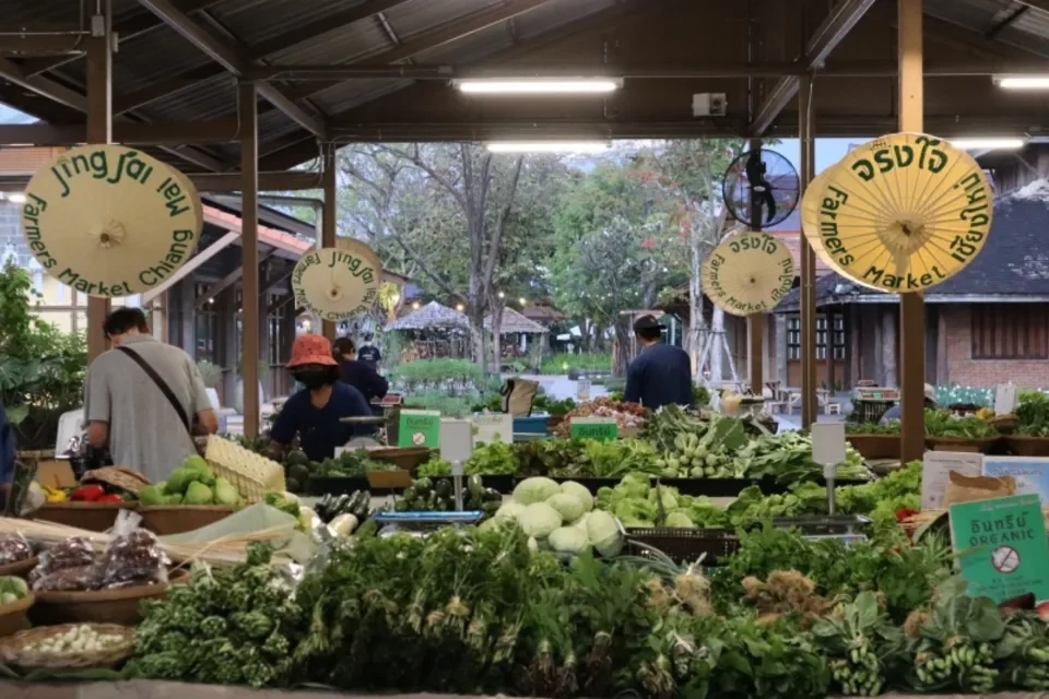
Produce stalls in the weekend farmers’ section of Jing Jai Market in Chiang Mai.
6
Along the Ping and Beyond the Moat
Pair the market with a walk on one bank of the Ping. Use the exact bridge or street approach before continuing to a separate neighbourhood.
1
Warorot Market (Kad Luang)
Praisanee Road · Chang Moi, near the Ping
Kad Luang is a working grocery market for Northern Thai foods, snacks and ingredients. It also gives you a start for exploring the surrounding market streets.
Use the exact Warorot hall pin before walking in from the river. Visit by day if you want to shop inside the main building.
The weekend farmers’ and craft market brings together growers, prepared-food stalls and handmade goods. Go early if you want to browse produce before breakfast.
Use the Jing Jai Central site in Chiang Mai. The operator lists the weekend market from 06:30 to 15:00. Shops in the wider complex follow their own schedule.
Chang Khlan Road near Loi Kroh Road, Chang Khlan, Mueang Chiang Mai
Evening stalls and indoor halls cluster along Chang Khlan Road around the Night Bazaar building.
Start at the junction with Loi Kroh Road. Pick a particular market hall if you want a fixed meeting point because stalls and halls keep separate hours.
Bamrung Buri Road by Chiang Mai Gate, Phra Sing, Mueang Chiang Mai District, Chiang Mai
The covered morning grocery hall beside Chiang Mai Gate has produce and meat stalls. The outdoor food stalls trade at a different time.
Use the Bamrung Buri Road entrance on the Old City side of the gate. The government market profile lists 03:00–11:00 for the fresh hall, with individual stall hours varying.
The silver-coloured hall displays the embossed metalwork associated with Wua Lai. You can see much of the exterior from the courtyard.
Find the temple in Wua Lai and follow posted rules for each building. Women can visit the grounds, and temple signs restrict entry to the silver ordination hall.
Doi Suthep–Pui National Park road, Suthep, Mueang Chiang Mai District, Chiang Mai
The hillside village has public lanes with textiles and craft stalls along the visitor route.
Continue beyond the Doi Suthep junction and park at the village approach. Allow time for narrow bends, and ask permission before photographing residents.
The artist village gathers workshops, craft stalls and cafés around shared paths. Ask directly about a class if you want to make something during your visit.
Use the Soi Ban Ram Poeng entrance in Suthep. Thailand’s tourism authority lists Tuesday through Sunday, 10:00–18:00. Individual studios set their own hours.
Chiang Mai University, Suthep, Mueang Chiang Mai District, Chiang Mai
The banks give a view over water to the hills at the edge of Chiang Mai University. It is a short open-air stop on the west side of town.
Use an open university gate and follow campus directions. Follow the university’s current traffic and visitor rules and stick to marked paths by the water.
Choose an activity from the wildlife park’s day and night tram programmes. There are separate timings for tram rides and other activities.
Use the visitor entrance for 33 Moo 12 outside the city. Check the official programme and book the correct session. Set the return pickup in advance if you visit in the evening.
Check the garden’s current entry fee and choose the greenhouse or canopy route when you arrive. Then decide whether you have daylight for another stop.
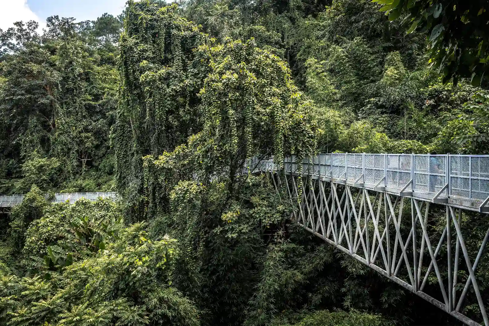
Canopy walkway at Queen Sirikit Botanic Garden in Mae Rim.
10
Mae Rim Mae Sa and Samoeng
Use one valley route for the day and check park gates if continuing to a waterfall. Save viewpoints for clear weather.
1
Queen Sirikit Botanic Garden
100 Moo 9, Mae Rim–Samoeng Road, Mae Raem, Mae Rim District, Chiang Mai
Pick the greenhouse collections and canopy walkway if you want two different ways to see the Mae Sa forest and cultivated plants.
Use the signed garden entrance on the Mae Rim–Samoeng road. Check the current entry fee and ask at the desk how to move between hillside areas.
Ask at the cave which chambers are open. A mountain trek has separate access arrangements and may need prior permission.
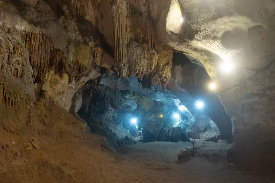
An illuminated limestone chamber inside Chiang Dao Cave.
12
Mae Taeng and Chiang Dao
Treat a cave visit, a waterfall and a permit-based hike as separate choices. Check current open areas and use the ranger or ticket office pin where needed.
1
Bua Tong–Nam Phu Chet Si Park
Mae Ho Phra, Mae Taeng District, Chiang Mai
Bua Tong has pale limestone waterfall terraces and a separate spring area within the same park.
Use the visitor centre above the waterfall and check which levels are open. Follow the posted routes and water access rules.
Dam visitor area, Ban Pao, Mae Taeng District, Chiang Mai
The dam-side visitor area has long views across the reservoir. Boats can connect to floating facilities when they are operating.
Follow signs for Mae Ngat Dam from Mae Taeng and use the dam-side visitor approach. Confirm boat operation and departure points before making a trip for the water.
Ban Tham, Chiang Dao Subdistrict, Chiang Dao District, Chiang Mai
The temple grounds lead to limestone chambers with rock formations and Buddhist images. The partially lit visit and guided unlit passages use the same cave complex.
Walk through Wat Tham Chiang Dao to the cave mouth. Ask which chambers are open and about a local guide for dark sections. Expect damp rock and steps.
Chiang Dao Wildlife Sanctuary, Chiang Dao District, Chiang Mai
The authorised route crosses limestone terrain via Ang Salung campsite. Views from the summit depend on the weather.
The initial 26–30 October booking period for the 2026–27 season has ended. A confirmed sanctuary reservation and briefing are required. Follow the assigned transfer and Den Ya Khat start details.
Agree on a pickup point before walking into a village. A workshop or homestay needs booking with the host.
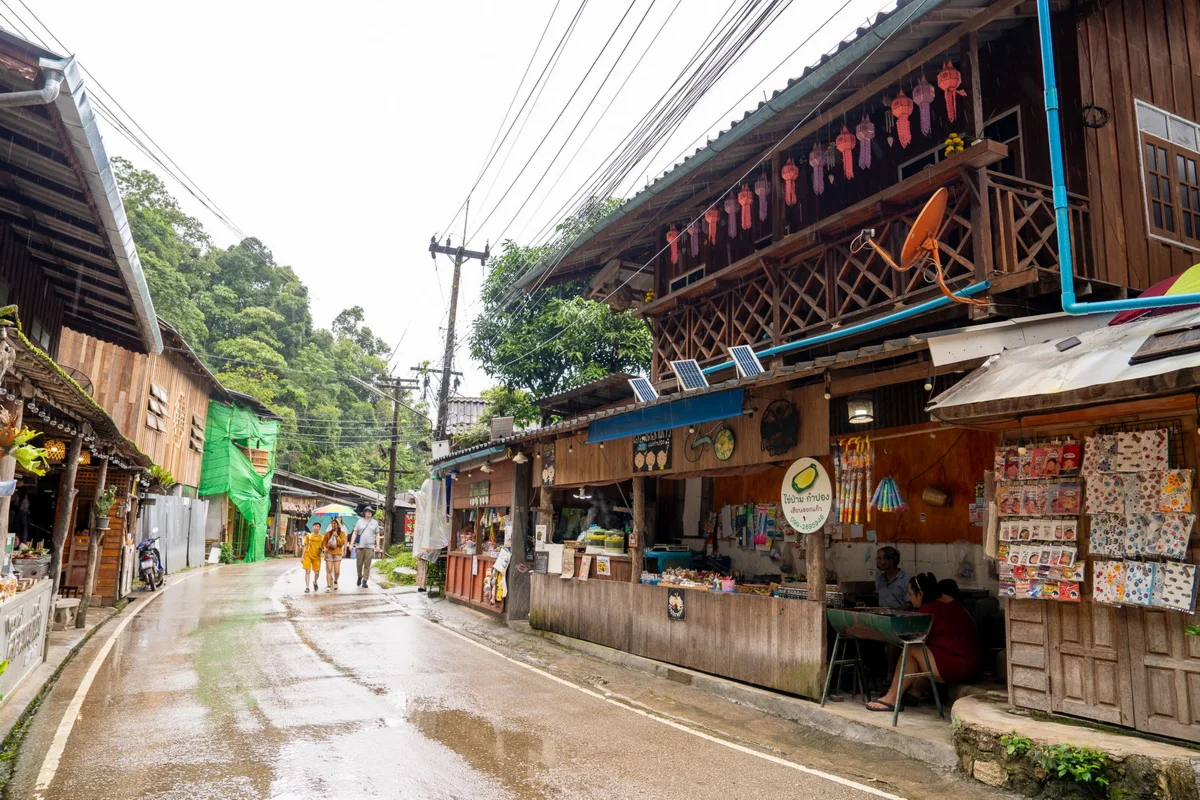
Mae Kampong village in Mae On district, Chiang Mai.
14
Eastern Chiang Mai Valleys
Pick a village or spring as the main stop. Arrange a workshop ahead if you want something that takes more time than a walk through the village.
1
MAIIAM Contemporary Art Museum
122 Moo 7, Ton Pao · San Kamphaeng
Come for contemporary Thai and regional art, with collection displays and rotating exhibitions in the same complex.
Follow Route 1006 to the mirror-fronted building at 122 Moo 7 in Ton Pao. The museum lists Wednesday to Monday, 10:00–18:00. Check admission and the current exhibition before setting out.
Above Mae Kampong, Huai Kaeo, Mae On District, Chiang Mai
The short path above Mae Kampong opens onto several layers of mountain ridges when visibility is good.
Use the signed upper approach above the village. The final road is steep. Check local transport and park access before setting off for sunrise or after rain.
Ban Sahakon Subdistrict, Mae On District, Chiang Mai
The signed paths go past the thermal jets and channels. The complex also has facilities built for foot soaking and mineral baths.
Enter the Ban Sahakon visitor grounds from the signed Mae On road. The ministry reported a partial closure in April 2026. Confirm which grounds and baths have reopened before setting off.
The park road climbs through distinct stops. Keep the summit and any long walk early enough to allow for fog, road travel and the return before dark.
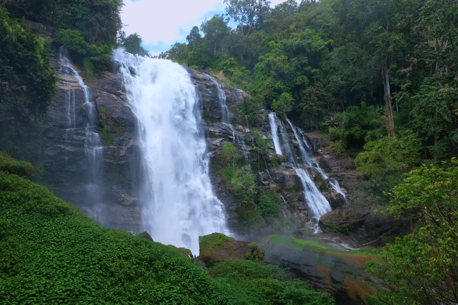
Wachirathan Waterfall in Doi Inthanon National Park.
16
Doi Inthanon and Southern Chiang Mai
Set aside daylight for the mountain road and choose one trail by current access and time. The park’s visitor stops have separate entrances and opening windows.
1
Doi Inthanon National Park
Doi Inthanon National Park · Chom Thong and neighbouring districts
The park spans waterfall stops, cloud forest and Thailand’s highest summit. Pick stops along the road according to daylight and your group’s walking time.
Allow time for the approach from Chom Thong, the park checkpoint and travel between village, waterfall, trail and summit stops. Check the park’s day-of notices.
A guided ridge and cloud-forest walk with open viewpoints when the weather allows. The park reopened the trail for the winter season on 1 November 2026.
Arrive at the Kew Mae Pan car park, arrange the required local guide and ask about conditions and entry windows. The higher ridge can be cool and wet.
Nam Phrae Subdistrict, Hang Dong District, Chiang Mai
The lower trails look into a rocky gorge where the river passes polished boulders. Water levels change the view and access.
Follow the Nam Phrae road to the ranger and visitor area. Check the river instructions after heavy rain, especially if you were planning a riverside walk.
Rice terraces wrap the hillside. The scene changes from irrigated paddies to green growth, ripening rice and harvested fields.
Ask locally about the access road and current growing stage before travelling from Mae Chaem. Use visitor paths and avoid walking onto working terraces.
Save the approach for the exact attraction in Fang or Mae Ai. A base in the north can spare a long return drive after dark.
Ang Khang Royal Agricultural Station in Fang district.
18
Northern Chiang Mai Province
Check road conditions and route time before making a day trip from Chiang Mai city. A local base may make it easier to start early in a distant district.
1
Wat Tham Tap Tao
Ban Tham Tap Tao, Si Dong Yen Subdistrict, Chai Prakan District, Chiang Mai
The grounds include a pond and a small scripture pavilion. The Pha Khao and Pha Mued caves contain Buddhist images and natural formations.
Take the Ban Tham Tap Tao turnoff from Highway 107 in Chai Prakan. Ask which cave sections are open and bring footwear with grip.
Doi Pha Hom Pok National Park headquarters, Pong Nam Ron, Fang District, Chiang Mai
Steaming pools and vents mark the park headquarters’ geothermal field. There are separate facilities for mineral bathing when available.
Follow the headquarters signs from Fang to Pong Nam Ron. Stay behind the thermal barriers and check current soaking facilities and admission at the park desk.
Doi Pha Hom Pok National Park, summit in Mae Ai District, approach from Fang, Chiang Mai
The route climbs from forest to a high ridge and a summit about 2,285 metres above sea level. Views depend on wind and fog.
Arrange the trek with the Fang park headquarters. Check access to Kiew Lom campground, park bookings and any ranger or vehicle requirements before leaving town.