ThailandNavigator
Thailand Guide

75 Beaches Across Southern Thailand

Find 75 southern Thailand beaches by coast and island, with exact access points, road or boat planning, and beach-day examples.

Reading time
24 min read
Reviewed
Reviewed
Editorial owner
Thailand Navigator Editorial Team
Context
Phuket Island
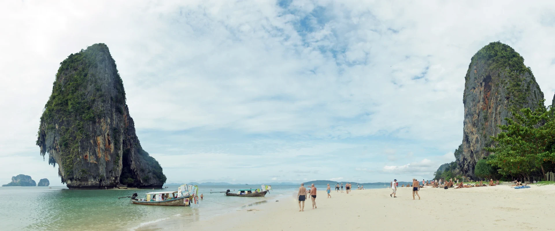
Panoramic view of Phra Nang beach and limestone cliffs at Railay
Phra Nang beach on the Railay peninsula.
This guide provides general information from reviewed sources. Requirements can change and individual circumstances vary. Check the latest official requirements before acting.
Quick answer

Choose the shore and the route

Use the beach map pin first. On islands and peninsulas, check which pier or landing your operator uses.

Phuket West-coast resort shores and smaller coves
Phang Nga and Ranong Long Andaman shores, park beaches and a quieter island
Krabi Mainland and Ko Phi Phi Road-accessible coast, boat landings and limestone bays

Browse by area

Choose the option that best matches your situation to see the most relevant part of this guide.

Start by choosing the coast, the base and the way you want to reach the water. This guide covers 75 named beaches and beach bays. Each entry gives the place, access and a practical reason to choose it, with a link to the exact Thailand Navigator map.

Road beaches work when you need a flexible start or have a flight later. On boat days, check where the operator leaves from, which shore they use for landing and when the return runs. Save the place pin and the departure pier as separate locations.

Check the marine forecast and local beach flags on the day. Wind, swell and tide can change boat routes and swimming conditions. Park beaches also have seasonal access and local rules. Agree an alternative near your base if the boat or park plan changes.

1

Four ways to plan a beach day

1

A short north Phuket outing

1. Nai Yang Beach Use this coastal approach near the airport and set a separate pickup for the terminal.

2. Sirinat National Park Check access arrangements if including a park area on the same outing.

2

A Railay day from the mainland

1. Ao Nam Mao Pier Check the land-side departure point if your route uses the east landing.

2. Railay East Pier Confirm the boat’s landing and return, then follow the pedestrian route across the peninsula.

3. Phra Nang Cave Beach Allow time for the approach on foot and follow beach-specific signs.

3

A Khao Lak beach day by road

1. Bang Niang Beach Use the beach approach that matches your pickup or accommodation.

2. Khuk Khak Beach Check the separate public approach to the north before continuing.

4

Before boarding for Ko Lipe

1. Pak Bara Pier Confirm the operator, check-in time, landing and return before you leave the mainland.

2. Ko Lipe Pattaya Beach Passenger Landing Use the confirmed drop-off and check how you will reach your lodging from the landing.

2

What to book for an island beach

Ao Kueak Beach in the Similans and Mai Ngam Beach in the Surin Islands are seasonal marine park visits. Confirm your electronic park ticket, the exact boat itinerary and the mainland pier before paying.

Ko Kradan East Beach uses the Trang island routes. Ask how and where the boat lands. For Ko Nang Yuan Sandbar Beach check the separate visitor admission window and the last pickup before leaving Ko Tao.

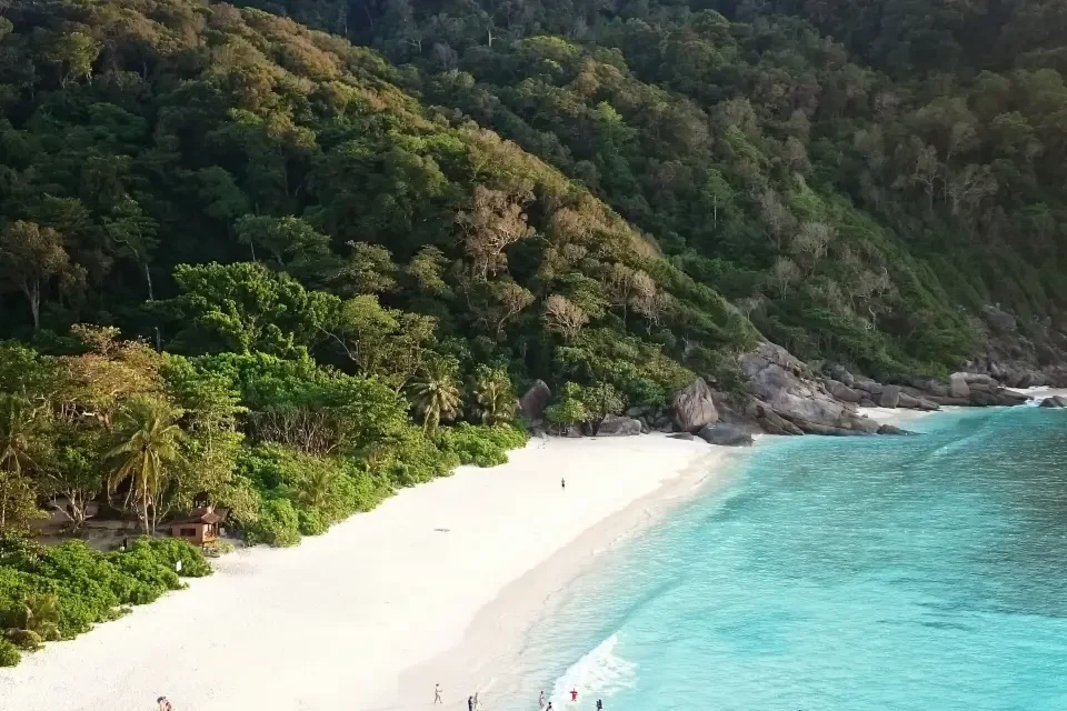
Ao Kueak’s pale beach below granite and forest on Similan Island No. 8
Ao Kueak’s pale beach below granite and forest on Similan Island No. 8.
3

Choose a coast and a public approach

Save the right access road and follow the flags when you arrive.

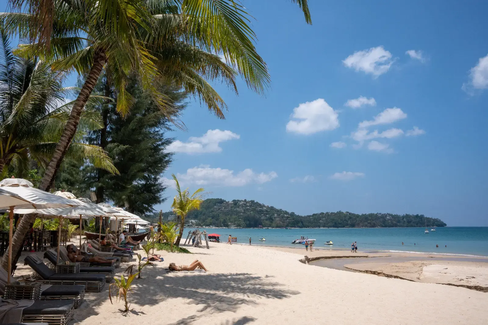
Shoreline at Bang Tao Beach on the west coast of Phuket
Bang Tao Beach, Phuket.
4

Phuket

Use the exact public approach for the part of the beach you want. Leave time for a road transfer if two beaches sit on opposite sides of a headland.

1

Bang Tao Beach

Choeng Thale, Thalang, west Phuket

A long western shoreline with several distinct beach approaches. The village end and the Laguna area work as different starting points.

Choose the stretch you want before arranging a ride. Use the village for the south end and look for the public approach in the Laguna area for the middle.

View place and directions

2

Karon Beach

Karon, Mueang Phuket, southwest Phuket

The open stretch of shore suits a longer beach walk with transport pickups along the parallel road.

Use a specific beach-road landmark for pickup. If you continue towards Kata, use the street connections between the two beaches.

View place and directions

3

Kamala Beach

Kamala, Kathu, west Phuket

The crescent of sand sits on the bay north of Patong, with village roads close to the southern end.

Choose an approach on the Kamala village side for the southern and central parts. Give your driver the road-side pickup point as well as the beach name.

View place and directions

4

Nai Harn Beach

Nai Harn bay, Rawai, Mueang Phuket

A sandy southern bay in Rawai, with Nong Han Lake just behind it. The lake road is a useful landmark.

Take the road around Nong Han Lake from Rawai. Use the named beach pin and agree where to meet your driver near the waterfront.

View place and directions

5

Nai Yang Beach

Sakhu, Thalang, northwest Phuket

This bay near Phuket airport sits along the Sirinat National Park coast. It works for a short shore visit with a separate ride to the airport.

Approach from Nai Yang village in Sakhu, south of the airport. Follow signs for any park areas you plan to enter.

View place and directions

6

Mai Khao Beach

Mai Khao, Thalang, northwest Phuket

The long northwest shoreline is also recorded as sea-turtle nesting habitat. Airport-end plane viewing and the quieter stretches have separate approaches.

Choose a specific part of Mai Khao before going. Follow airport and park signs near the runway end and stay outside closed nesting areas.

View place and directions

7

Kata Noi Beach

Kata Noi Road, Karon, Mueang Phuket

Kata Noi is the smaller bay south of Kata, reached from its own road. Choose it if you want this smaller cove on a southwest Phuket day.

Follow Kata Noi Road from the south end of Kata and use a signed public access. Give a driver the full name Kata Noi.

View place and directions

8

Surin Beach

Choeng Thale, Thalang, west Phuket

Surin is a single bay between Kamala and Bang Tao. Its direct shore approach makes it easy to plan a separate stop.

Take the signed turn from the west-coast road to the shorefront. Use a specific public access as your ride meeting point.

View place and directions

9

Patong Beach

Pa Tong, Kathu, west Phuket

Patong pairs a resort beach with nearby shops, meals and visitor services. Boat and water-sport activity varies along the shore.

For the central stretch, use Thawewong Road near the seaward end of Bangla Road. Follow signs for swimming areas and separate boat lanes.

View place and directions

10

Ya Nui Beach

Rawai, between Windmill Viewpoint and Promthep Cape, Mueang Phuket District, Phuket

This small southern Phuket inlet sits between Windmill Viewpoint and Promthep Cape.

Use the roadside access and mapped parking by the beach. Sea conditions change with wind and swell. Follow flags and local guidance.

View place and directions

11

Kata Beach

Karon, Mueang Phuket, Phuket

The broad arc looks out towards Ko Pu. The southern end has a rocky edge and nearby surf schools.

Use Soi Pak Bang from the Karon–Kata road for the south end. Ask for Kata Yai or Kata Beach and follow flags and lifeguards on the day.

View place and directions

12

Nai Thon Beach

Sa Khu, Thalang, northwest coast, Phuket

The open sand curves around a small northwest Phuket bay, with coastal trees behind the northern end.

Take the Sa Khu junction towards Nai Thon and use the coastal beach road. Check flags before entering the exposed Andaman water.

View place and directions

13

Layan Beach

Choeng Thale, Thalang, northwest Phuket, Phuket

Coastal trees, a creek mouth and a small offshore island give the northern shore a different setting from the resort frontage to the south.

Follow the local road from Choeng Thale to the Layan beach approach. Check the tide and stay on the mainland side of the creek if flow or depth is uncertain.

View place and directions

14

Ao Yon Beach

Wichit, Mueang Phuket, Cape Panwa peninsula, Phuket

The western sandy section looks across an anchorage to the Panwa headlands. Boats and exposed foreshore change the experience with the tide.

Use Ao Yon–Khao Khad Road and specify the western approach when arranging a ride. Use the road between stretches if the rocky foreshore is covered.

View place and directions

15

Laem Singh Beach

Kamala, Kathu, between Kamala and Surin, Phuket

The sand sits below a wooded slope between Kamala and Surin. The roadside viewpoint gives an open look across the cove.

Ask locally at Surin about a boat and confirm the landing and return. Use the roadside viewpoint if rough surf affects beach access.

View place and directions

5

Match the named shore with your route

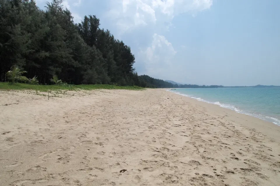
The Khao Lak area includes a number of different beaches and park entrances.

A sandy beach at Khao Lak–Lam Ru National Park in Phang Nga
A beach at Khao Lak–Lam Ru National Park.
6

Phang Nga and Ranong

Khao Lak covers several named beaches. Confirm the public road or park entrance. Treat the Ranong islands as separate trips with their own schedules.

1

Bang Niang Beach

Khuek Khak, Takua Pa District, Phang Nga

The Bang Niang shore sits west of the inland Khao Lak neighbourhood of the same name.

Take Chai Hat Bang Niang Road towards the sea and use the signed public access for your chosen stretch.

View place and directions

2

Khuk Khak Beach

Khuek Khak, Takua Pa District, Phang Nga

This Khao Lak shoreline extends north of Bang Niang, along a distinct part of the Takua Pa coast.

Use a signed public beach road through Khuek Khak. Save the access point because the shoreline name covers a longer stretch.

View place and directions

3

Nang Thong Beach

Near Bang La On, Khao Lak, Takua Pa District, Phang Nga

The coastal approach from Bang La On makes Nang Thong a convenient Khao Lak stop when staying near the main road.

Follow Nang Thong Road down to the signed public beach paths. Save the exact access if you are being collected later.

View place and directions

4

Natai Beach

Khok Kloi, Takua Thung, Phang Nga

A long open Andaman frontage with a pier that serves as a separate landmark along the sand.

Use the public beach road from Khok Kloi. If coming from Phuket, cross the Sarasin Bridge first. Check flags and conditions on arrival.

View place and directions

5

Thai Mueang Beach

Thai Mueang, Thai Mueang District, Phang Nga

Woodland backs the long shore, which includes sea-turtle nesting habitat. The town and national park areas have separate approaches.

Follow the coast road from Thai Mueang town and use the signed park access for the northern part. Follow any marked protection areas.

View place and directions

6

Ao Kueak Beach (Donald Duck Bay)

Northwest cove of Ko Similan, Island No. 8, Phang Nga

Pale sand curves below the granite Sail Rock viewpoint on Similan Island No. 8. The viewpoint approach has exposed steps.

Choose a trip that lists Island No. 8 and confirm the mainland pier. Arrange the park e-ticket in advance and check weather, access and swimming directions before boarding.

View place and directions

7

Mai Ngam Beach

West side of Ko Surin Nuea, Mu Ko Surin National Park, Khura Buri, Phang Nga

Wooded headlands frame a shallow bay on Ko Surin Nuea. At low tide there is a longer stretch between the sand and the waterline.

Confirm whether your park boat lands at Mai Ngam or connects via Chong Khad. Check which transfer or walking route is open. Campsite bookings are a separate arrangement.

View place and directions

8

Bang Sak Beach

Bang Muang, Takua Pa, Phang Nga

A long, pale stretch of shore with shade from coastal trees and food stops along the beach lanes.

Turn off Highway 4 onto the beach road. Agree on the same access lane for pickup and check the flags before swimming.

View place and directions

9

Ao Yai Beach (Ko Phayam)

Southwestern Ko Phayam, Mueang Ranong, Ranong

A broad bay on Ko Phayam’s southwest coast where the tide can leave a long walk to the water.

Take the passenger boat from Ranong and use the island road to Ao Yai. Confirm the mainland return sailing and ask locally about southwest swell.

View place and directions

10

Ao Khao Khwai Beach

North shore of Buffalo Bay, western Ko Phayam, Mueang Ranong, Ranong

The rocky northern edge of Buffalo Bay sits beneath a wooded headland. Low tide exposes sand and rocks along the shore.

Specify the north side of Buffalo Bay when leaving Ko Phayam’s passenger pier. Check the tide and stay clear of boat lanes.

View place and directions

7

Krabi Mainland and Ko Phi Phi

Save the named shore and the boat side. Some Railay approaches use a different pier from the beach you plan to visit.

1

Ao Nang Beach

Ao Nang, Mueang Krabi, Krabi

The public seafront gives an open view of the bay and access to the longtail departure area.

Check the exact operator and boarding point before setting out. The Ao Nang waterfront, Noppharat Thara Pier and Ao Nam Mao Pier are separate departure points.

View place and directions

2

Maya Bay

Ko Phi Phi Le, Krabi

The protected sandy bay lies inside a limestone rim on Ko Phi Phi Le. Visitors come for the landscape from the designated shore route.

Confirm current park access and tickets with the boat operator. Land at Loh Samah and use the park walkway. Swimming is prohibited at Maya Bay.

View place and directions

3

Phra Nang Cave Beach

South of Railay, Ao Nang Subdistrict, Mueang Krabi

The shore sits under cliffs at the southern end of Railay, beside the cave and shrine area.

Use the public cliffside path across the peninsula. Check your return boat before walking and leave space around the shrine.

View place and directions

4

Railay West Beach

Railay West Beach, Thailand

Railay West faces the Andaman Sea under limestone cliffs and is reached by boat. It works as a beach and peninsula walking stop.

Confirm the route, landing side and return with the operator. Some boats use wet boarding or steps and some arrive at Railay East instead.

View place and directions

5

Noppharat Thara Beach

Ao Nang, Mueang Krabi, Krabi

The beach faces limestone islands. Low tide exposes a broad sandy shore, with small shells visible in places.

Follow the coastal road west from Ao Nang and use the western approach near the park headquarters. Check the tide and confirm a separate ferry departure point if taking a boat.

View place and directions

6

Ton Sai Beach (Railay)

Between Ao Nang and Railay West, Ao Nang, Mueang Krabi, Krabi

This Krabi mainland cove sits under climbing cliffs, with longtails and tidal rocks in the shallows.

Ask about a direct mainland Ton Sai landing from Ao Nang. If approaching via Railay, check the forest path and tide locally before attempting a shoreline connection.

View place and directions

7

Tubkaek Beach

Nong Thale, Mueang Krabi, Krabi

The west-facing shore gives a clear view of offshore islands, and lower water can expose a wide set of shallows.

Take the coastal road north from Khlong Muang and confirm a public beach entrance. The Dragon Crest trail uses a separate approach.

View place and directions

8

Khlong Muang Beach

Nong Thale, Mueang Krabi, Krabi

Look across the water towards islands. The shoreline changes from sand to rocks and tidal flats along the bay.

Drive through Nong Thale and arrange pickup at the exact public beach approach. Check the tide before a longer walk, and follow signs around boats.

View place and directions

9

Loh Dalum Beach

North side of the Ton Sai isthmus, Ko Phi Phi Don, Mueang Krabi, Krabi

The north-facing Phi Phi Don beach arcs between wooded limestone slopes. Low water reveals a wide sandy area.

Walk from Ton Sai Pier through the central lanes. Save a separate ferry meeting point and check the tide before arranging a kayak.

View place and directions

10

Railay East Beach

Eastern Railay peninsula, Ao Nang, Mueang Krabi, Krabi

The eastern shore reveals broad mud and sand flats beside mangroves at low water. It gives views along the promenade and access to the floating landing.

Confirm a boat from Ao Nam Mao or walk the signed paths from Railay West. Choose the eastern side for a shoreline walk and boat access.

View place and directions

11

Ko Hong Main Beach

Main visitor beach on Ko Hong, Krabi, Krabi

The main visitor sand faces turquoise shallows and limestone stacks. The island’s interior lagoon is a separate stop.

Confirm your boat itinerary includes this beach and save the mainland departure point. Follow the ranger route from the floating landing and check park conditions.

View place and directions

8

Confirm the island shore and boarding point

Ko Kradan, Ko Muk and Ko Lanta trips use different routes. Ask the operator for the exact landing and the return before leaving the mainland.

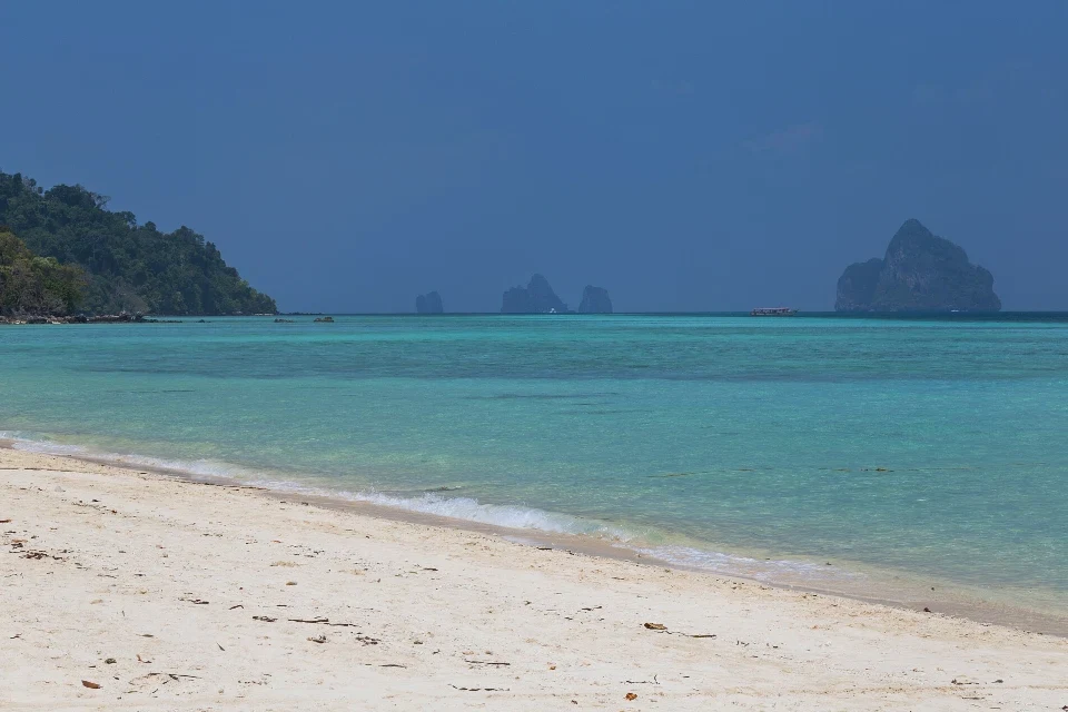
Pale sand on Ko Kradan’s east shore with Ko Muk and other limestone islands in the distance
Pale sand on Ko Kradan’s east shore with Ko Muk and other limestone islands in the distance.
9

Ko Lanta and Trang

Choose the exact island pier and check for tide-dependent shore landings. On Lanta, allow road time between northern and southern beaches.

1

Khlong Dao Beach (Ko Lanta)

Khlong Dao Beach (Ko Lanta), Thailand

The northwest Lanta shore is close to the island’s northern visitor services, making it a convenient base for a shorter beach day.

Use a designated access or your accommodation’s agreed path. Confirm the return ride before setting out from another part of Lanta.

View place and directions

2

Khlong Nin Beach

Ban Khlong Nin, Ko Lanta Yai Subdistrict, Krabi

The long central west-coast beach lies by Ban Khlong Nin on Lanta Yai. Choose a stretch to match a meal or an evening stop.

Use the signed public path from the village’s coastal road. Allow road time from northern Lanta and follow local water notices.

View place and directions

3

Phra Ae Beach (Long Beach)

West coast of Ko Lanta Yai, Sala Dan Subdistrict, Krabi

Phra Ae is the long west-coast shore commonly called Long Beach. A public park gives a useful starting point at the south end.

Use the Phra Ae Public Health Park pin for the southern approach. The main beach pin sits farther north along the sand.

View place and directions

4

Ba Kantiang Beach

Southwestern Ko Lanta Yai, Ko Lanta, Krabi

The southwestern Lanta bay has an open curve of sand between green headlands. Start from the village end if you want a longer view down the bay.

Follow the road south from Khlong Nin into Ba Kantiang village. Ask for the public approach and leave time for road transfers farther south.

View place and directions

5

Pak Meng Beach

Mai Fat, Sikao, Trang

The broad Trang shore looks towards Ko Meng and smaller limestone shapes. The long beach road provides several approaches.

Drive west from Sikao through Mai Fat to the signed waterfront. Save the pier separately if taking an island boat.

View place and directions

6

Khlong Khong Beach

Sala Dan, western Ko Lanta Yai, Ko Lanta, Krabi

The west-facing sand opens onto rocky shallows. At low water the intertidal area is a large part of the view.

Take the west-coast road south from Sala Dan past Phra Ae. Agree on a lane for pickup and check the tide before wading.

View place and directions

7

Khlong Chak Beach

Southwestern Ko Lanta Yai, Ko Lanta, Krabi

The low sandy shore is backed by steep green hills near the southern end of Lanta Yai. The waterfall is a separate inland trip.

Continue past Ba Kantiang and use the Khlong Chak beach turn. Tell your driver you want the shore and arrange the return before travelling.

View place and directions

8

Farang Beach (Ko Muk)

West coast of Ko Muk, Kantang, Trang

A dark limestone headland frames the sand on Ko Muk’s west coast. The evening light is visible from the shoreline.

Cross from the island village towards the shore also called Charlie Beach. Arrange a ride back after dark and choose a separate boat plan for the sea cave.

View place and directions

9

Ko Kradan East Beach

East shore of Ko Kradan, Ko Libong, Kantang, Trang

The pale east shore looks towards Ko Muk and the Trang coast. The shallow reef and ranger area sit near the main visitor beach.

Confirm a boat from Khuan Tung Ku or Pak Meng and ask for the east beach landing. Check Hat Chao Mai park access and the return time. A dry bag helps on a shallow-water landing.

View place and directions

10

Confirm the boat landing

Ko Lipe’s main beaches sit on different sides of the island. Ask where your boat drops you before arranging the last leg.

Sandy Koh Lipe shore in Satun’s Andaman islands
Koh Lipe’s sandy shore in Satun.
11

Satun and the Tarutao Islands

Confirm the pier, boat and landing side with the operator before travelling. Park visits depend on the day’s route and announced access.

1

Pattaya Beach (Ko Lipe)

South shore of Ko Lipe, Mueang Satun, Satun

Ko Lipe’s south-facing crescent links to Walking Street, with boats using parts of the bay.

Walk to the south end of Walking Street or confirm the passenger landing with your operator. Follow the marked swimming and vessel areas.

View place and directions

2

Sunrise Beach (Ko Lipe)

East shore of Ko Lipe, Mueang Satun, Satun

The eastern shore faces the morning light and small offshore islets. The north end looks across the channel towards Ko Adang.

Use the coastal lane nearest your accommodation or follow Walking Street across the island. Check local wind and currents before going out towards any offshore islet.

View place and directions

3

Sunset Beach (Ko Lipe)

Northwest shore of Ko Lipe, Mueang Satun, Satun

The small northwest bay has rocky edges and an open late-afternoon view. The shore is also known as Hat Pramong.

Approach through the inland lanes. Bring a light for a walk back after dusk and check water levels around the rocky edges.

View place and directions

4

Ao Son Beach

West coast of Ko Tarutao, Mueang Satun, Satun

Forested headlands frame the quieter Tarutao bay. Expect both sand and gravel along its shore.

Ask the park headquarters at Ao Pante Malaka about the onward trip, local access and return. Keep to the areas open for visitors if wildlife notices are posted.

View place and directions

5

Pak Bara Beach

Pak Nam, La-ngu, along the Pak Bara coastal road, Satun

A mainland shore with offshore island views and flats that open as the tide falls.

Use the beach approach off Route 4052. If you’re catching a boat, leave time to check in at the separate Pak Bara passenger terminal.

View place and directions

6

Hat Sai Khao Beach (Ko Rawi)

Southeastern Ko Rawi, Tarutao National Park, Mueang Satun, Satun

A ranger beach facing Ko Adang across the channel, with forest just behind the sand.

Book a licensed excursion that specifies the Hat Sai Khao landing. Confirm current park access and follow the marked swimming areas.

View place and directions

7

Pante Malaka Beach

Northwest Ko Tarutao, Mueang Satun, Satun

A broad pale shore just south of the visitor centre and park pier on northwestern Ko Tarutao.

Confirm a boat call at Ao Pante Malaka before leaving Pak Bara. Ask the park about the beach path, return sailing and separate campsite booking if staying overnight.

View place and directions

12

Plan by the part of Samui you will stay in

Choose a base with convenient beach access, then save the road route for other bays.

View over Chaweng Beach from the Koh Samui coast
Chaweng Beach on Koh Samui, viewed from between Lamai and Chaweng.
13

Ko Samui

Pick the part of Samui that matches your ferry or airport transfer. Confirm the public path when the approach runs between resort grounds.

1

Bophut Beach

Bo Phut, Koh Samui, Surat Thani

The west side of Bophut’s waterfront gives an open view across the bay. Fisherman’s Village is a nearby stop on the village streets.

Follow Thanon Haad Bo Phut and use a signed approach to the sand. Pick a separate street-side meeting point for rides.

View place and directions

2

Chaweng Beach

Bo Phut, east coast of Ko Samui

The main east-coast beach runs in front of different parts of Chaweng, with separate passages to the shore.

Choose a public passage near your starting point. Confirm its exact pickup address if meeting a driver after a walk.

View place and directions

3

Lamai Beach

Maret, Koh Samui, Surat Thani

Lamai’s long curve and coconut-lined shore give room for a walk from the town-facing section.

Use the mapped footpath from the central Lamai streets. Check flags at the point where you intend to go into the water.

View place and directions

4

Choeng Mon Beach

Choeng Mon, Bo Phut, Koh Samui, Surat Thani

This smaller bay on the northeast of Samui has sand between rocky edges.

Use Choeng Mon Beach Access Road and follow the final walking approach from public parking. Keep to the posted beach guidance.

View place and directions

5

Lipa Noi Beach

Lipa Noi, Koh Samui, Surat Thani

A west-facing shore on Samui where the beach pin sits north of the ferry terminal.

Use the local coastal road and the signed shoreline access. Save the terminal separately if you have a ferry to catch.

View place and directions

6

Mae Nam Beach

Mae Nam, Koh Samui, Surat Thani

The quieter north-coast shoreline can be reached from Mae Nam village and has a clear central landmark.

Use the streets near the Chinese temple and continue to the waterfront rotunda. Confirm separate boarding directions if combining it with a ferry.

View place and directions

7

Bang Po Beach

Mae Nam, northwest Ko Samui, Surat Thani

The northwest shore looks north across the Gulf from the village. Lower tide exposes shallow and rocky parts of the bay.

Use the ring road through Bang Po and agree on a specific coastal lane for pickup. Check tidal rocks and local warnings before entering the water.

View place and directions

8

Chaweng Noi Beach

Bo Phut, east coast of Ko Samui, Surat Thani

Pale sand curves between rocky edges below the hills immediately south of the main Chaweng area.

Follow Route 4169 south and confirm a public entrance or beachfront pickup. Save a separate pin if visiting the main Chaweng Beach as well.

View place and directions

9

Silver Beach (Ko Samui)

Maret, east coast of Ko Samui, Surat Thani

Granite boulders frame the pale sand and shallows of the Maret cove. It is also known as Thong Ta Kian or Crystal Bay.

Follow the signed shore lane off the east-coast ring road. Check waves and look for partly submerged rocks when the water is low.

View place and directions

14

Ask about the return leg on island days

A regular ferry brings you to an island’s pier. Beach access can involve a separate road or longtail trip.

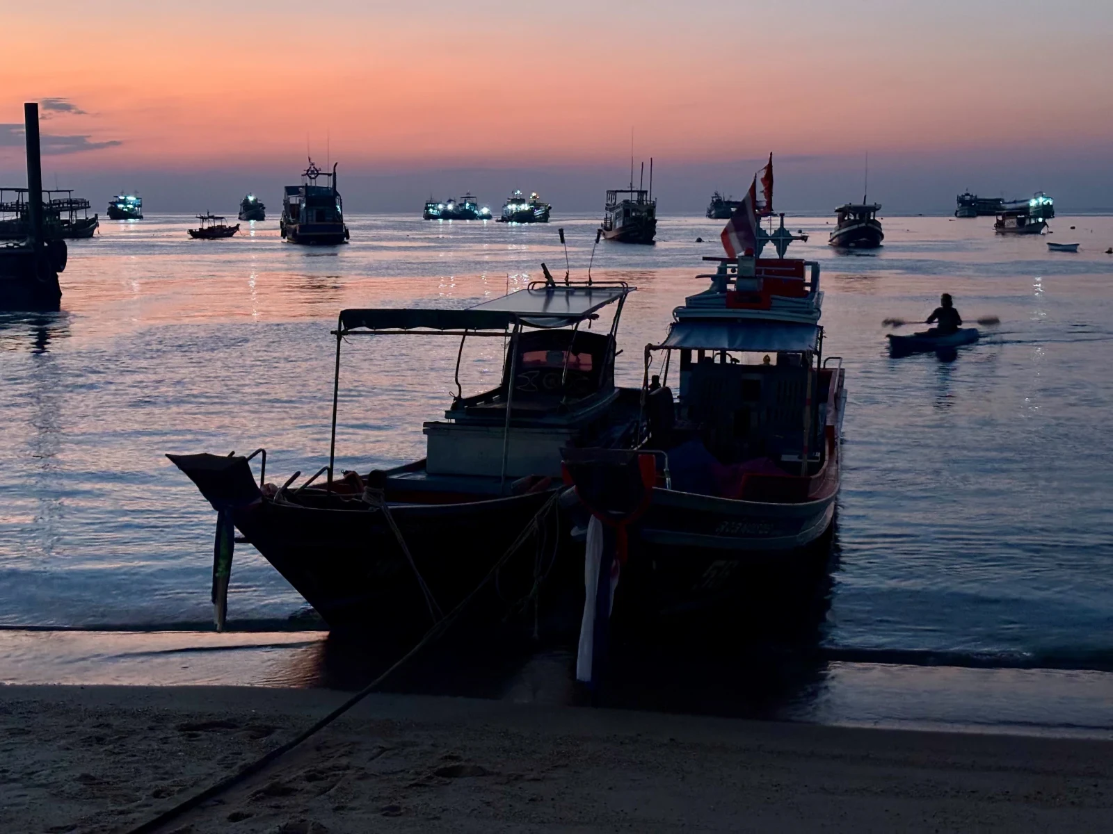
Boats in shallow water off Sairee Beach on Koh Tao
Longtail boats on Koh Tao’s Sairee coast at sunset.
15

Ko Pha Ngan and Ko Tao

Budget road or boat time between bays. Ask about beach access and return arrangements when the route includes a steep road or small boat.

1

Haad Rin Nok Beach

Ban Tai, southeastern Ko Pha Ngan

The sandy east side of the Haad Rin peninsula is the event beach. It also gives a different shoreline from the west-facing bay.

Follow signs to the east beach from Haad Rin. If visiting on event dates, check access and late transport first.

View place and directions

2

Sairee Beach

Sairee village, west coast of Ko Tao

Sairee runs along Ko Tao’s west coast near the village, with more than one path down to the sand.

Use a public path from Sairee village. Choose a specific pickup point and allow time to return to the ferry area.

View place and directions

3

Tanote Bay Beach

East coast of Ko Tao, Ko Pha Ngan District, Surat Thani

Rounded granite boulders sit offshore from this east-facing Ko Tao cove. The road drops steeply on its final approach.

Take the road east across the island. Arrange a driver if needed, and check visibility and boat activity before swimming or snorkelling.

View place and directions

4

Haad Son Beach

West coast of Ko Pha Ngan, Surat Thani

Rocks and foliage edge the west-facing cove below the hillside road. It receives late-afternoon light.

Use the signed downhill foot approach from the west-coast road north of Sri Thanu. Meet your driver at the roadside if the access path is steep.

View place and directions

5

Bottle Beach

Remote northern shore of Ko Pha Ngan, Surat Thani

The north-coast bay curves between green headlands away from the island’s main road. Longtails approach from the open side.

Ask in Chaloklum about a boat to Hat Khuat, or arrange an appropriate vehicle with a local driver. Confirm the return before leaving.

View place and directions

6

Ao Leuk Beach

Southeastern Ko Tao, Ko Pha Ngan District, Surat Thani

The sand opens between Ko Tao’s southeastern headlands. The deeper water beyond the shallows can suit snorkelling when conditions allow.

Use the southeastern road and confirm the final driveway or access arrangement. Follow boat and reef signs if entering the water.

View place and directions

7

Chaloklum Beach

Chalok Lam village, north coast of Ko Pha Ngan, Surat Thani

The shoreline curves around the fishing village bay and looks across to headlands. Working boats use the area around the pier.

Follow the north road to Ban Chalok Lam and use a village beach lane. Confirm a separate meeting point for a taxi boat and stay clear of the approach lanes.

View place and directions

8

Ko Nang Yuan Sandbar Beach

Visitor sandbar between the Ko Nang Yuan islets, northwest of Ko Tao, Surat Thani

Narrow sandy links connect the islets and change shape with the tide. The southern viewpoint looks over the sand and reef areas.

Confirm the visitor pier, return boat and admission before leaving Ko Tao. The operator lists day access from 10:00 to 15:00 and restrictions on single-use bottles and fins.

View place and directions

16

Give mainland beaches their own route

Choose one stretch for a road day and keep time to reach the next district.

Nai Phlao Beach along the Khanom coast
Nai Phlao Beach, Khanom.
17

Gulf Mainland from Chumphon to Songkhla

Choose one mainland stretch for the day. Where a beach name occurs in another province, match the district and exact map before leaving.

1

Nai Phlao Beach

Khanom District, Nakhon Si Thammarat

This sandy stretch sits on Khanom’s coastal road in Nakhon Si Thammarat. It works as one stop on a mainland beach day.

Follow a signed local public route to the shore. Check beach conditions on arrival, especially if visiting after wind or rain.

View place and directions

2

Samila Beach

Bo Yang, Mueang Songkhla District

The Songkhla shoreline near the Golden Mermaid provides a clear landmark for a short waterfront walk.

Use the Golden Mermaid approach for the northern beachfront. Follow local notices if planning to enter the water.

View place and directions

3

Thung Wua Laen Beach

Saphli, Pathio, Chumphon

The sandy Saphli frontage bends towards a wooded rocky end. The central beach road provides a clear starting point.

Follow Route 3180 towards Saphli from Chumphon. Check the Gulf forecast and local flags before setting out into the water.

View place and directions

4

Hat Sai Ri Beach (Chumphon)

Hat Sai Ri, Mueang Chumphon, Chumphon

The Gulf shore looks towards low offshore islands. A memorial and a retired naval vessel are nearby landmarks.

Follow Routes 4119 and 4098 from Chumphon to the beachfront. Use separate signs if continuing to the memorial, and check water and wind conditions.

View place and directions

5

Chalatat Beach

Bo Yang, Songkhla city seafront, Mueang Songkhla, Songkhla

An open Gulf shoreline with a municipal recreation area nearby for a seafront walk.

Pick a public path along the Hat Chalatat coastal road and set a specific pickup point. Check flags and local swell advice before entering the water.

View place and directions

6

Ao Thong Yee Beach

South of Nai Phlao, Khanom District, Nakhon Si Thammarat

A short cove south of Nai Phlao, with wooded slopes at both ends of the strand.

Continue south from Nai Phlao to the signed approach after checking the condition of the final road. Bring water and arrange your ride back.

View place and directions

18

Plan the rest of the trip

Phuket Travel Tips for First-Time Visitors Choose an area and check Phuket’s road and airport approaches.

Ao Nang, Railay or Krabi Town? Compare road and boat bases for the limestone coast.

Khao Lak and Mainland Phang Nga Plan a stay on the Phang Nga mainland and check the beach access.

Trang Islands and Koh Lipe Compare the approaches to islands off Trang and Satun.

Koh Samui, Koh Phangan or Koh Tao? Check the different ferry piers and the travel choices between Gulf islands.

Sources and review

Sources used for this guide

Sources are reviewed regularly so important changes can be reflected in the guide.

Suggest content

Help us improve Thailand Navigator.
What would you like to do?

Your account, current page and submission date are recorded automatically.

Community experiences

Reviews of 75 Beaches Across Southern Thailand

Read first-hand experiences, then share your own.

Write a review
Loading member reviews…
Reviews reflect members’ own experiences.

Want to write a review?

Closing this prompt will not remove your rating.

Choose language

Select the language used across Thailand Navigator.

You can change this any time from the language menu.