
Province guide
Chachoengsao
Chachoengsao is an eastern Thai province shaped by the Bang Pakong River, revered temples, riverside markets, orchards and forested districts.
Official source · View sourceUnderstand the areas
Explore the areas within Chachoengsao and find a place for your visit or everyday life.
The interactive map loads as it comes into view.
Open full map →Ban Pho DistrictBan Pho District is an administrative district (amphoe) in Chachoengsao Province, Thailand.Bang Khla DistrictBang Khla District is an administrative district (amphoe) in Chachoengsao Province, Thailand.Bang Nam Priao DistrictBang Nam Priao District is an administrative district (amphoe) in Chachoengsao Province, Thailand.Bang Pakong DistrictBang Pakong District is an administrative district (amphoe) in Chachoengsao Province, Thailand.Explore the geographic hierarchy →
Places by type





Explore Chachoengsao
Browse places by type and discover what to see and do in Chachoengsao.
History & culture
Explore Thailand’s rich history through ancient ruins, landmarks and monuments.
Explore places (0) →Religious sites
Visit Buddhist temples, shrines, churches and mosques across Thailand.
Explore places (0) →Nature & scenery
Discover beaches, islands, waterfalls, caves and breathtaking viewpoints.
Explore places (0) →Parks & outdoors
Explore national parks, trails, gardens and incredible wildlife.
Explore places (0) →Public spaces
Find vibrant squares, bridges and iconic public places.
Explore places (0) →Transport
Find airports, railway stations, bus and ferry terminals across Thailand.
Explore places (0) →Local categories
Things to do
Browse local businesses and services by type.
Local categories will appear as connected listings are published.
Browse every category in Chachoengsao →
Find a business or service in Chachoengsao
Search published businesses and services in this area.
Businesses in Chachoengsao
View more businesses →No connected businesses are published yet.
Living in Chachoengsao
Explore neighbourhoods, everyday services and practical information for a longer stay.
Choose an area to learn about living in Chachoengsao
Each area has its own character. Follow the local guides to learn more.
Ban Pho District
Ban Pho District is an administrative district (amphoe) in Chachoengsao Province, Thailand.
Bang Khla District
Bang Khla District is an administrative district (amphoe) in Chachoengsao Province, Thailand.
Bang Nam Priao District
Bang Nam Priao District is an administrative district (amphoe) in Chachoengsao Province, Thailand.
Bang Pakong District
Bang Pakong District is an administrative district (amphoe) in Chachoengsao Province, Thailand.
Compare selected areas
Everyday essentials
HealthcareHospitals, clinics and medical services.Explore →
Schools & familyEducation and everyday family life.Explore →
Shopping & marketsLocal shops, markets and essentials.Explore →
Getting aroundLocal transport, taxis and vehicle hire.Explore →
Working remotelyCoworking and professional services.Explore →
More ways to use Chachoengsao
Plan the practical details
Find transport options and useful information for visiting Chachoengsao.
Getting to Chachoengsao
Explore routes and transport connections. Check current schedules and availability before travelling.



Getting around Chachoengsao
Find local transport services and practical guidance.

Essential travel information
Weather in Chachoengsao
November to February for generally cooler, drier conditions; confirm market days and forest access before travel.
Loading current conditions and forecast…
Nearby destinations
Explore more places and local guides.
Na Mueang Subdistrict
Na Mueang Subdistrict is an official tambon in Mueang Chachoengsao District, Chachoengsao, Thailand. · 0.4 km away
Sothon Subdistrict
Sothon Subdistrict is an official tambon in Mueang Chachoengsao District, Chachoengsao, Thailand. · 2.9 km away
Bang Tin Pet Subdistrict
Bang Tin Pet Subdistrict is an official tambon in Mueang Chachoengsao District, Chachoengsao, Thailand. · 3.4 km away
Bang Phra Subdistrict
Bang Phra Subdistrict is an official tambon in Mueang Chachoengsao District, Chachoengsao, Thailand. · 4.4 km away
About Chachoengsao
Chachoengsao is an eastern Thai province beside Bangkok whose communities and farms are closely tied to the Bang Pakong River. The historic provincial town, widely known as Paet Riu, is the main base for services and rail connections, while the province's 11 districts range from lowland river country to forested land in the east.
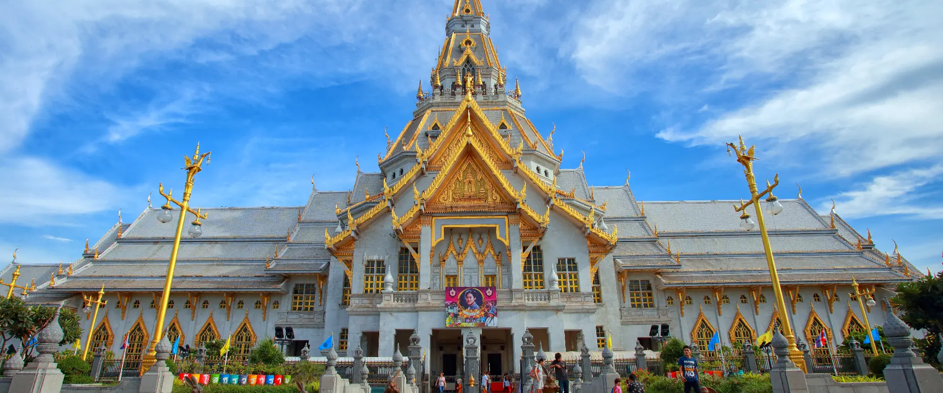
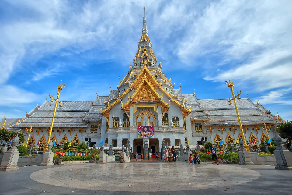
Wat Sothon Wararam Worawihan, home to the revered Luang Pho Sothon image, is the province's best-known spiritual landmark. The old-town and river experience can be extended to Baan Mai Riverside Market, while Bang Khla is known for its riverside food market and Wat Pak Nam Jolo. Khlong Khuean adds a prominent standing Ganesha landmark.
Beyond the river settlements, Tha Takiap District reaches the forest landscape of Khao Ang Rue Nai Wildlife Sanctuary. Chachoengsao is also strongly agricultural, with fertile river and canal systems supporting orchards and crops; mangoes are especially associated with the province. Market days, fruit seasons and site opening arrangements should be checked before setting out.
Chachoengsao can be reached from Bangkok by road and rail. The provincial capital is the easiest base for temples, markets and onward local transport, but attractions are spread across several districts, so a private vehicle or arranged driver is useful for a wider circuit. Check current train and bus timetables directly with operators.
November to February generally brings the most comfortable weather for walking and outdoor visits. March to May is hotter, and monsoon months bring greener scenery with heavier rain and possible disruption to rural or forest access. Carry water and sun protection year-round, and use footwear with grip in wet conditions.
Dress modestly and follow posted rules at temples. Arrive early at popular religious sites, keep noise low during worship, and do not touch sacred objects. For wildlife areas, confirm current access, hours and safety instructions with the responsible authority; never approach or feed wild animals. A practical first visit combines Mueang Chachoengsao with one river-market area, while forest destinations deserve a separate, well-planned day.
- Sources
- View source
- Last reviewed
- 19 September 2026
- Content owner
- Thailand Navigator Editorial Team
- Page type
- Province guide