
Province guide
Chaiyaphum
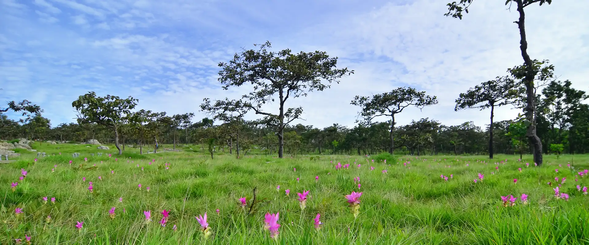
Chaiyaphum is a mountain-and-plateau province of northeastern Thailand, celebrated for national parks, waterfalls, rock formations and seasonal Dok Krachiao fields.
Official source · View sourceUnderstand the areas
Explore the areas within Chaiyaphum and find a place for your visit or everyday life.
The interactive map loads as it comes into view.
Open full map →Bamnet Narong DistrictBamnet Narong District is an administrative district (amphoe) in Chaiyaphum Province, Thailand.Ban Khwao DistrictBan Khwao District is an administrative district (amphoe) in Chaiyaphum Province, Thailand.Ban Thaen DistrictBan Thaen District is an administrative district (amphoe) in Chaiyaphum Province, Thailand.Chatturat DistrictChatturat District is an administrative district (amphoe) in Chaiyaphum Province, Thailand.Explore the geographic hierarchy →
Bamnet Narong District →Ban Khwao District →Ban Thaen District →Chatturat District →Kaeng Khro District →Kaset Sombun District →Khon San District →Khon Sawan District →Mueang Chaiyaphum District →Noen Sa-Nga District →Nong Bua Daeng District →Nong Bua Rawe District →Phakdi Chumphon District →Phu Khiao District →Sap Yai District →Thep Sathit District →
Places by type





Explore Chaiyaphum
Browse places by type and discover what to see and do in Chaiyaphum.
History & culture
Explore Thailand’s rich history through ancient ruins, landmarks and monuments.
Explore places (0) →Religious sites
Visit Buddhist temples, shrines, churches and mosques across Thailand.
Explore places (0) →Nature & scenery
Discover beaches, islands, waterfalls, caves and breathtaking viewpoints.
Explore places (0) →Parks & outdoors
Explore national parks, trails, gardens and incredible wildlife.
Explore places (0) →Public spaces
Find vibrant squares, bridges and iconic public places.
Explore places (0) →Transport
Find airports, railway stations, bus and ferry terminals across Thailand.
Explore places (0) →Local categories
Things to do
Browse local businesses and services by type.
Local categories will appear as connected listings are published.
Browse every category in Chaiyaphum →
Find a business or service in Chaiyaphum
Search published businesses and services in this area.
Businesses in Chaiyaphum
View more businesses →No connected businesses are published yet.
Living in Chaiyaphum
Explore neighbourhoods, everyday services and practical information for a longer stay.
Choose an area to learn about living in Chaiyaphum
Each area has its own character. Follow the local guides to learn more.
Bamnet Narong District
Bamnet Narong District is an administrative district (amphoe) in Chaiyaphum Province, Thailand.
Ban Khwao District
Ban Khwao District is an administrative district (amphoe) in Chaiyaphum Province, Thailand.
Ban Thaen District
Ban Thaen District is an administrative district (amphoe) in Chaiyaphum Province, Thailand.
Chatturat District
Chatturat District is an administrative district (amphoe) in Chaiyaphum Province, Thailand.
Compare selected areas
Everyday essentials
HealthcareHospitals, clinics and medical services.Explore →
Schools & familyEducation and everyday family life.Explore →
Shopping & marketsLocal shops, markets and essentials.Explore →
Getting aroundLocal transport, taxis and vehicle hire.Explore →
Working remotelyCoworking and professional services.Explore →
More ways to use Chaiyaphum
Plan the practical details
Find transport options and useful information for visiting Chaiyaphum.
Getting to Chaiyaphum
Explore routes and transport connections. Check current schedules and availability before travelling.



Getting around Chaiyaphum
Find local transport services and practical guidance.

Essential travel information
Weather in Chaiyaphum
July for the TAT-highlighted Dok Krachiao season; November to February for generally cooler hiking and road travel. Check park conditions before visiting.
Loading current conditions and forecast…
Nearby destinations
Explore more places and local guides.
Nai Mueang Subdistrict
Nai Mueang Subdistrict is an official tambon in Mueang Chaiyaphum District, Chaiyaphum, Thailand. · 2.4 km away
Rop Mueang Subdistrict
Rop Mueang Subdistrict is an official tambon in Mueang Chaiyaphum District, Chaiyaphum, Thailand. · 2.6 km away
Nong Na Saeng Subdistrict
Nong Na Saeng Subdistrict is an official tambon in Mueang Chaiyaphum District, Chaiyaphum, Thailand. · 6.5 km away
Bung Khla Subdistrict
Bung Khla Subdistrict is an official tambon in Mueang Chaiyaphum District, Chaiyaphum, Thailand. · 7.1 km away
About Chaiyaphum
Chaiyaphum lies along the western edge of the Khorat Plateau, where forested mountains, uplands and central plains meet. Mueang Chaiyaphum is the main service base, while the province's 16 districts spread across a large landscape that rewards planning by area rather than trying to cover everything in one day.
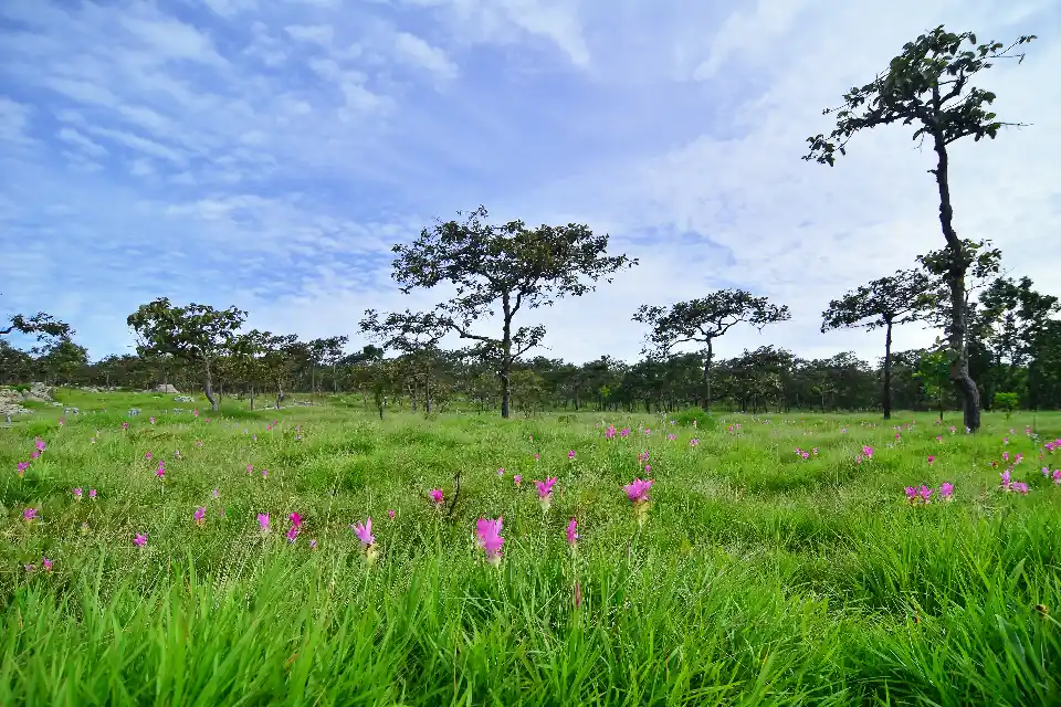
Nature is the main reason to visit. Tat Ton National Park is convenient from the provincial capital; Phu Laen Kha National Park includes the striking Mo Hin Khao rock formations; and Pa Hin Ngam and Sai Thong national parks are associated with seasonal Dok Krachiao blooms, waterfalls, viewpoints and walking routes. Conditions and access vary with weather, conservation work and the flowering season.
The best month depends on the trip. TAT highlights July for Dok Krachiao fields and misty rainy-season scenery. November to February is generally cooler and more comfortable for broader hiking and road travel. The hot season can be demanding, while heavy rain may make trails, rocks and waterfall areas slippery or temporarily inaccessible.
Chaiyaphum is principally reached and explored by road. Interprovincial buses serve the province, but national parks and rural trailheads may require a private vehicle, local transfer or arranged driver. Distances are substantial: group Mueang Chaiyaphum with Tat Ton or Phu Laen Kha, and treat Thep Sathit and the southern flower-field parks as a separate circuit.
The province also has a layered cultural history with Dvaravati, Khmer and Lao-Lan Xang influences, alongside the local memory of Phraya Phakdi Chumphon. Ban Khwao is associated with silk traditions. Visitors should treat temples, monuments and community craft settings respectfully and ask before photographing people or active work.
Check park announcements, opening status and trail rules before departure, especially in the rainy season. Wear footwear with grip, carry drinking water, sun and rain protection, and allow extra daylight for mountain roads. Do not leave marked trails, enter closed waterfall zones or disturb plants and wildlife. Accommodation around seasonal flower events can fill quickly, so reserve early and verify bloom conditions close to travel.
- Sources
- View source
- Last reviewed
- 19 September 2026
- Content owner
- Thailand Navigator Editorial Team
- Page type
- Province guide