

Province guide
Chumphon
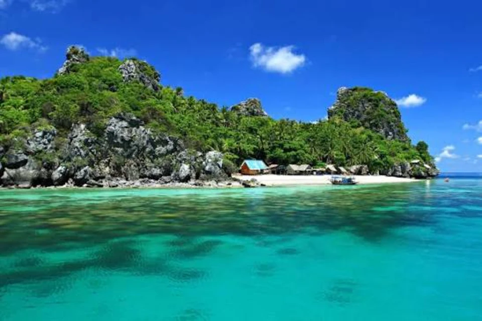
Chumphon is a quieter Gulf-coast province and southern gateway, known for beaches, offshore islands, fishing communities, diving, raptor migration and access to Ko Tao.
Official source · View sourceUnderstand the areas
Explore the areas within Chumphon and find a place for your visit or everyday life.
The interactive map loads as it comes into view.
Open full map →Lamae DistrictLamae District is an administrative district (amphoe) in Chumphon Province, Thailand.Lang Suan DistrictLang Suan District is an administrative district (amphoe) in Chumphon Province, Thailand.Mueang Chumphon DistrictMueang Chumphon District is an administrative district (amphoe) in Chumphon Province, Thailand.Pathio DistrictPathio District is an administrative district (amphoe) in Chumphon Province, Thailand.Explore the geographic hierarchy →
Places by type





Explore Chumphon
Browse places by type and discover what to see and do in Chumphon.
History & culture
Explore Thailand’s rich history through ancient ruins, landmarks and monuments.
Explore places (0) →Religious sites
Visit Buddhist temples, shrines, churches and mosques across Thailand.
Explore places (0) →Nature & scenery
Discover beaches, islands, waterfalls, caves and breathtaking viewpoints.
Explore places (5) →Parks & outdoors
Explore national parks, trails, gardens and incredible wildlife.
Explore places (0) →Public spaces
Find vibrant squares, bridges and iconic public places.
Explore places (0) →Transport
Find airports, railway stations, bus and ferry terminals across Thailand.
Explore places (0) →Local categories
Things to do
Browse local businesses and services by type.
Local categories will appear as connected listings are published.
Browse every category in Chumphon →
Find a business or service in Chumphon
Search published businesses and services in this area.
Businesses in Chumphon
View more businesses →No connected businesses are published yet.
Living in Chumphon
Explore neighbourhoods, everyday services and practical information for a longer stay.
Choose an area to learn about living in Chumphon
Each area has its own character. Follow the local guides to learn more.
Lamae District
Lamae District is an administrative district (amphoe) in Chumphon Province, Thailand.
Lang Suan District
Lang Suan District is an administrative district (amphoe) in Chumphon Province, Thailand.
Mueang Chumphon District
Mueang Chumphon District is an administrative district (amphoe) in Chumphon Province, Thailand.
Pathio District
Pathio District is an administrative district (amphoe) in Chumphon Province, Thailand.
Compare selected areas
Everyday essentials
HealthcareHospitals, clinics and medical services.Explore →
Schools & familyEducation and everyday family life.Explore →
Shopping & marketsLocal shops, markets and essentials.Explore →
Getting aroundLocal transport, taxis and vehicle hire.Explore →
Working remotelyCoworking and professional services.Explore →
More ways to use Chumphon
Plan the practical details
Find transport options and useful information for visiting Chumphon.
Getting to Chumphon
Explore routes and transport connections. Check current schedules and availability before travelling.



Getting around Chumphon
Find local transport services and practical guidance.

Essential travel information
Weather in Chumphon
January to April is often the most practical period for beach and boat plans; check Gulf marine forecasts and operator notices year-round.
Loading current conditions and forecast…
Nearby destinations
Explore more places and local guides.
Tham Sing Subdistrict
Tham Sing is a foothill subdistrict in Mueang Chumphon closely associated with Robusta coffee cultivation and processing. · 1.5 km away
Wisai Nuea Subdistrict
Wisai Nuea is a Mueang Chumphon tambon with farming communities, the Khlong Wisai irrigation system and recognised coffee-growing land. · 3.6 km away
Wisai Tai Subdistrict
Wisai Tai is a Sawi tambon with agricultural communities, a horticultural research centre and local irrigation projects. · 7.9 km away
Mueang Chumphon District
Mueang Chumphon District is an administrative district (amphoe) in Chumphon Province, Thailand. · 8.2 km away
About Chumphon
Chumphon is the northern gateway to Southern Thailand, where a long Gulf coastline, forested hills and working fishing communities create a quieter alternative to the country's larger beach resorts. Around Mueang Chumphon, Hat Sai Ri, Khao Matsee and Mu Ko Chumphon National Park combine coastal scenery, viewpoints, mangroves and island trips. Farther north, Pathio District is the base for Hat Thung Wua Laen and Chumphon Airport; southward, Sawi, Lang Suan and Lamae lead to local beaches and communities, while inland Phato is known for rivers, forest and rafting activities.
Choose a base according to the trip. Chumphon town is most convenient for rail arrivals, markets, services and transfers to nearby piers; the Thung Wua Laen area suits an easy beach stay; and Lang Suan or Ko Phithak works for a slower community-focused coast. Boats from Chumphon also provide a gateway to Ko Tao, which belongs to Surat Thani Province, so do not confuse the ferry destination with Chumphon's own islands. Mu Ko Chumphon National Park and offshore sites support snorkelling and diving, while September and October are associated with the province's seasonal raptor migration. Access, park openings and marine trips can change with weather and conservation rules.
Chumphon covers 6,009.01 square kilometres. At 31 December 2024 it was divided into 8 districts, 70 subdistricts and 744 villages. Its registered population was 508,053 in 2024; this is the province-wide civil-registration count reported by Thailand's National Statistical Office from Department of Provincial Administration data, not a tourist count or the population of Chumphon town. Local food reflects the coast and southern region: fresh seafood, southern curries and rice noodles are widely associated with the province, along with lady-finger bananas, Sawi pineapple and bai liang leaves.
Chumphon lies on the main north-south road and railway corridors, and long-distance trains and buses make the provincial capital a practical stop between Bangkok and the lower south. Chumphon Airport is in Pathio District, north of the city; confirm current flights and allow for the onward road transfer. Ferry operators use different piers and schedules for island routes, so verify the correct terminal, check-in time and sea conditions before departure. For beach and boat plans, January to April is often the most practical window, but the tropical coast can receive rain at any time and Gulf conditions can deteriorate during monsoon periods. Build spare time around flight-ferry or train-ferry connections, carry sun and rain protection, and check official marine, park and operator notices shortly before travel.
- Sources
- View source
- Last reviewed
- 19 September 2026
- Content owner
- Thailand Navigator Editorial Team
- Page type
- Province guide