
Province guide
Lamphun
Lamphun is a compact northern province where the old Hariphunchai capital, revered temples, Yong textiles, longan country and Mae Ping forests sit just south of Chiang Mai.
Official source · View sourceUnderstand the areas
Explore the areas within Lamphun and find a place for your visit or everyday life.
The interactive map loads as it comes into view.
Open full map →Ban Hong DistrictBan Hong District is an administrative district (amphoe) in Lamphun Province, Thailand.Ban Thi DistrictBan Thi District is an administrative district (amphoe) in Lamphun Province, Thailand.Li DistrictLi District is an administrative district (amphoe) in Lamphun Province, Thailand.Mae Tha DistrictMae Tha District is an administrative district (amphoe) in Lamphun Province, Thailand.Explore the geographic hierarchy →
Places by type





Explore Lamphun
Browse places by type and discover what to see and do in Lamphun.
History & culture
Explore Thailand’s rich history through ancient ruins, landmarks and monuments.
Explore places (0) →Religious sites
Visit Buddhist temples, shrines, churches and mosques across Thailand.
Explore places (0) →Nature & scenery
Discover beaches, islands, waterfalls, caves and breathtaking viewpoints.
Explore places (0) →Parks & outdoors
Explore national parks, trails, gardens and incredible wildlife.
Explore places (0) →Public spaces
Find vibrant squares, bridges and iconic public places.
Explore places (0) →Transport
Find airports, railway stations, bus and ferry terminals across Thailand.
Explore places (0) →Local categories
Things to do
Browse local businesses and services by type.
Local categories will appear as connected listings are published.
Browse every category in Lamphun →
Find a business or service in Lamphun
Search published businesses and services in this area.
Businesses in Lamphun
View more businesses →No connected businesses are published yet.
Living in Lamphun
Explore neighbourhoods, everyday services and practical information for a longer stay.
Choose an area to learn about living in Lamphun
Each area has its own character. Follow the local guides to learn more.
Ban Hong District
Ban Hong District is an administrative district (amphoe) in Lamphun Province, Thailand.
Ban Thi District
Ban Thi District is an administrative district (amphoe) in Lamphun Province, Thailand.
Li District
Li District is an administrative district (amphoe) in Lamphun Province, Thailand.
Mae Tha District
Mae Tha District is an administrative district (amphoe) in Lamphun Province, Thailand.
Compare selected areas
Everyday essentials
HealthcareHospitals, clinics and medical services.Explore →
Schools & familyEducation and everyday family life.Explore →
Shopping & marketsLocal shops, markets and essentials.Explore →
Getting aroundLocal transport, taxis and vehicle hire.Explore →
Working remotelyCoworking and professional services.Explore →
More ways to use Lamphun
Plan the practical details
Find transport options and useful information for visiting Lamphun.
Getting to Lamphun
Explore routes and transport connections. Check current schedules and availability before travelling.



Getting around Lamphun
Find local transport services and practical guidance.

Essential travel information
Weather in Lamphun
November to February is generally cooler and drier; check air quality in the late dry season and park access during wet weather.
Loading current conditions and forecast…
Nearby destinations
Explore more places and local guides.
Nai Mueang Subdistrict
Nai Mueang Subdistrict is an official tambon in Mueang Lamphun District, Lamphun, Thailand. · 2.0 km away
Wiang Yong Subdistrict
Wiang Yong Subdistrict is an official tambon in Mueang Lamphun District, Lamphun, Thailand. · 2.6 km away
Ton Thong Subdistrict
Ton Thong Subdistrict is an official tambon in Mueang Lamphun District, Lamphun, Thailand. · 2.8 km away
Rim Ping Subdistrict
Rim Ping Subdistrict is an official tambon in Mueang Lamphun District, Lamphun, Thailand. · 4.0 km away
About Lamphun
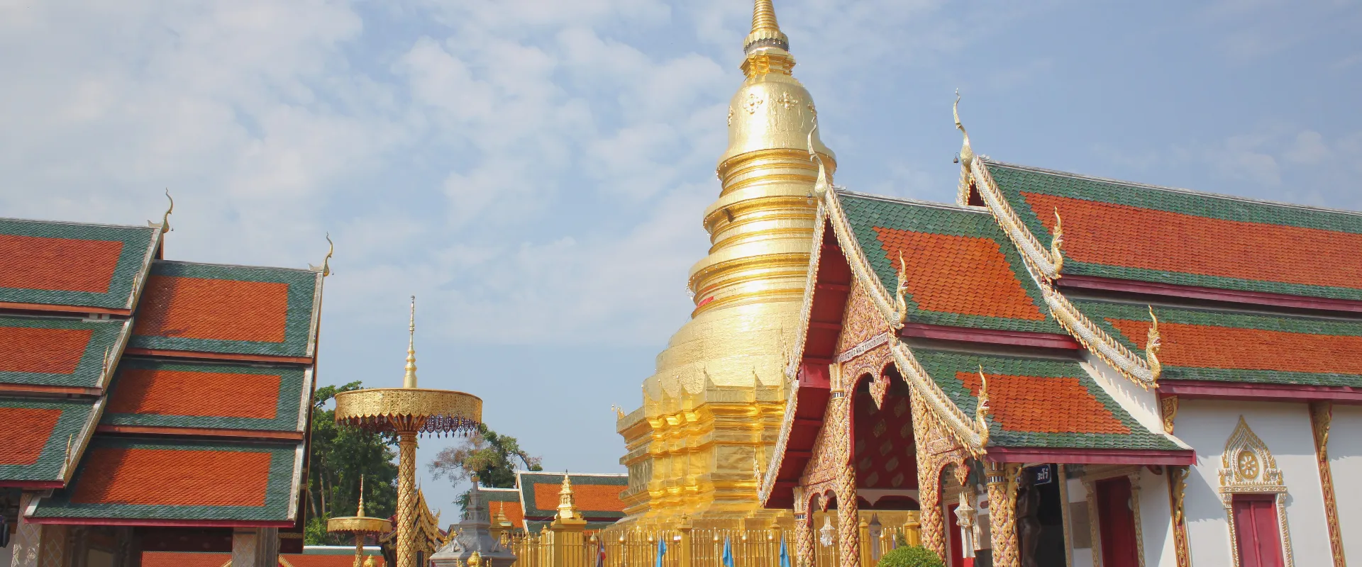
Lamphun is a compact Northern Thailand province whose capital preserves the legacy of Hariphunchai, the Mon kingdom that preceded Lanna rule in this part of the north. Within the old moated city, Wat Phra That Hariphunchai is the principal active temple, while Wat Chamthewi, the Queen Chamadevi Monument, community museums and quiet lanes reward a slower visit. Compared with neighbouring Chiang Mai, Lamphun feels more intimate and workaday, making it well suited to travellers interested in history, living religious culture and traditional craft communities.
Mueang Lamphun is the easiest base for the historic centre, riverside areas and the weaving community of Wiang Yong. Pa Sang is associated with cotton and yok dok silk weaving, while the wider lowlands are important longan-growing country. Farther south, Li District provides access to Mae Ping National Park, Ko Luang Waterfall and reservoir landscapes, and Ban Hong, Thung Hua Chang and Wiang Nong Long lead into quieter rural and mountain areas. These southern districts require substantially more travel time than a day trip around Lamphun city.
Lamphun covers 4,505.88 square kilometres. At 31 December 2024 it was divided into 8 districts, 51 subdistricts and 577 villages. Its registered population was 396,753 in 2024; this is the province-wide civil-registration count reported by Thailand's National Statistical Office from Department of Provincial Administration data, not the population of Lamphun city and not a visitor count. Lamphun city lies south of Chiang Mai on the Northern Line railway and main road corridors. Trains, buses and shared local transport serve the urban corridor, but a car or arranged driver is more practical for Li, Mae Ping National Park and dispersed craft or farming communities; Chiang Mai is the nearest major airport.
November to February generally brings the most comfortable weather for walking through the old city. March and April are hot and late-dry-season haze can affect air quality, while the May-to-October wet season brings greener scenery, storms and potentially slippery park trails. A focused day covers the historic centre and nearby weaving areas; allow additional days for Pa Sang or the southern districts. Dress respectfully at active temples and follow posted access rules, ask before photographing artisans, check DNP notices before visiting Mae Ping, and treat harvest timing, market days and transport schedules as variable. Travellers staying in Chiang Mai can visit central Lamphun as a day trip, but an overnight stay gives the city a quieter early-morning and evening atmosphere.
- Sources
- View source
- Last reviewed
- 19 September 2026
- Content owner
- Thailand Navigator Editorial Team
- Page type
- Province guide