
Culture & heritage
Mab Prachan Water Measurement Point
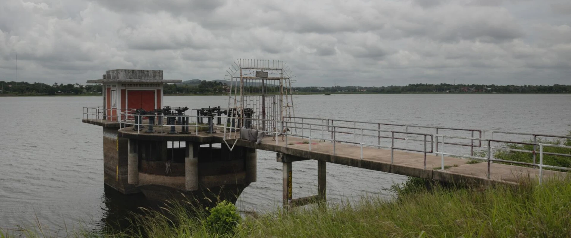
A reservoir-side reference point mapped as Mab Prachan water measurement, with a concrete platform and water-management equipment visible from the shore.
About Mab Prachan Water Measurement Point
Mab Prachan Water Measurement Point is the map label for a reservoir-side location in Pong, Bang Lamung, at reference WXP5+78. This record identifies the small shoreline feature rather than the whole reservoir or the separate Map Prachan Reservoir Park.
The reviewed June 2025 photograph shows a concrete platform over the water, a small building, railings and water-management equipment linked to the shore by a narrow walkway. Its exact engineering function and current operational condition were not independently established; the page title follows the mapped name.
Treat the structure as reservoir infrastructure. A photograph of a walkway does not establish permission to enter it. Remain on clearly permitted public routes, follow signs and staff instructions, and keep clear of equipment and restricted areas.
No visitor opening schedule, admission service, toilets or designated parking were established for this point. Water levels and shore conditions change. This listing does not establish swimming, boating or fishing permission, or access to the platform.
Location map
Open full mapNearby & related places
Sources & review
Content owner: Thailand Navigator Editorial
- Exact mapped feature and reviewed June 2025 photograph of the reservoir structure
- Royal Irrigation Department water-management system: named Mab Prachan reservoir; general reservoir context, not this structure engineering specification
- Captured exact Google Maps record: mapped identity and coordinates
Last reviewed
Check official information for details that may change.
Community experiences
Reviews of Mab Prachan Water Measurement Point
Read first-hand experiences, then share your own.
Loading member reviews…
Reviews are temporarily unavailable. Please try again.
—
Ratings include stars without a written review.Rating distribution
No written reviews yet
Your experience could help the next visitor decide what to explore.
Be the first to share your experience
What stood out? What would you tell someone planning a visit? A short, honest review is enough.
Write a review