
Province guide
Nakhon Phanom
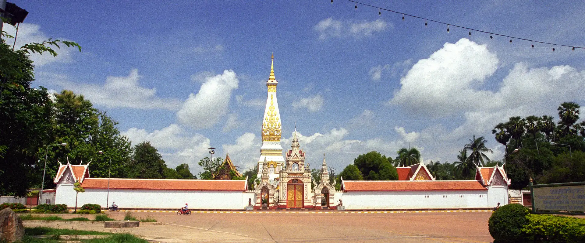
Nakhon Phanom is a Mekong-border province in northeastern Thailand known for riverfront life, revered Phra That temples, multi-ethnic culture, forests and views towards Laos.
Official source · National Statistical Office of ThailandUnderstand the areas
Explore the areas within Nakhon Phanom and find a place for your visit or everyday life.
The interactive map loads as it comes into view.
Open full map →Ban Phaeng DistrictBan Phaeng District is an administrative district (amphoe) in Nakhon Phanom Province, Thailand.Mueang Nakhon Phanom DistrictMueang Nakhon Phanom District is an administrative district (amphoe) in Nakhon Phanom Province, Thailand.Na Kae DistrictNa Kae District is an administrative district (amphoe) in Nakhon Phanom Province, Thailand.Na Thom DistrictNa Thom District is an administrative district (amphoe) in Nakhon Phanom Province, Thailand.Explore the geographic hierarchy →
Places by type





Explore Nakhon Phanom
Browse places by type and discover what to see and do in Nakhon Phanom.
History & culture
Explore Thailand’s rich history through ancient ruins, landmarks and monuments.
Explore places (0) →Religious sites
Visit Buddhist temples, shrines, churches and mosques across Thailand.
Explore places (0) →Nature & scenery
Discover beaches, islands, waterfalls, caves and breathtaking viewpoints.
Explore places (0) →Parks & outdoors
Explore national parks, trails, gardens and incredible wildlife.
Explore places (0) →Public spaces
Find vibrant squares, bridges and iconic public places.
Explore places (0) →Transport
Find airports, railway stations, bus and ferry terminals across Thailand.
Explore places (0) →Local categories
Things to do
Browse local businesses and services by type.
Local categories will appear as connected listings are published.
Browse every category in Nakhon Phanom →
Find a business or service in Nakhon Phanom
Search published businesses and services in this area.
Businesses in Nakhon Phanom
View more businesses →No connected businesses are published yet.
Living in Nakhon Phanom
Explore neighbourhoods, everyday services and practical information for a longer stay.
Choose an area to learn about living in Nakhon Phanom
Each area has its own character. Follow the local guides to learn more.
Ban Phaeng District
Ban Phaeng District is an administrative district (amphoe) in Nakhon Phanom Province, Thailand.
Mueang Nakhon Phanom District
Mueang Nakhon Phanom District is an administrative district (amphoe) in Nakhon Phanom Province, Thailand.
Na Kae District
Na Kae District is an administrative district (amphoe) in Nakhon Phanom Province, Thailand.
Na Thom District
Na Thom District is an administrative district (amphoe) in Nakhon Phanom Province, Thailand.
Compare selected areas
Everyday essentials
HealthcareHospitals, clinics and medical services.Explore →
Schools & familyEducation and everyday family life.Explore →
Shopping & marketsLocal shops, markets and essentials.Explore →
Getting aroundLocal transport, taxis and vehicle hire.Explore →
Working remotelyCoworking and professional services.Explore →
More ways to use Nakhon Phanom
Plan the practical details
Find transport options and useful information for visiting Nakhon Phanom.
Getting to Nakhon Phanom
Explore routes and transport connections. Check current schedules and availability before travelling.



Getting around Nakhon Phanom
Find local transport services and practical guidance.

Essential travel information
Weather in Nakhon Phanom
November to February is generally cooler and drier; verify current weather, park notices, flights and international-border requirements before travelling.
Loading current conditions and forecast…
Nearby destinations
Explore more places and local guides.
Na Khamin Subdistrict
Na Khamin Subdistrict is an official tambon in Phon Sawan District, Nakhon Phanom, Thailand. · 3.2 km away
Phon Sawan Subdistrict
Phon Sawan Subdistrict is an official tambon in Phon Sawan District, Nakhon Phanom, Thailand. · 5.0 km away
Phon Bok Subdistrict
Phon Bok Subdistrict is an official tambon in Phon Sawan District, Nakhon Phanom, Thailand. · 6.5 km away
Phon Sawan District
Phon Sawan District is an administrative district (amphoe) in Nakhon Phanom Province, Thailand. · 7.3 km away
About Nakhon Phanom
Nakhon Phanom occupies Thailand's western bank of the Mekong opposite Khammouane Province in Laos. Its provincial capital has a relaxed riverfront, views towards the mountains across the river and a heritage shaped by long movement between communities on both sides of the Mekong. The Tourism Authority of Thailand highlights Lao and other ethnic influences in local language, customs, food, architecture, welcoming ceremonies and regional dance traditions.
Plan the province by district. Mueang Nakhon Phanom is the practical base for the Mekong promenade, Wat Okat Si Bua Ban and Saint Anna Nong Saeng Catholic Church. That Phanom is the major pilgrimage destination for Wat Phra That Phanom, while Renu Nakhon is associated with Phu Thai culture and Phra That Renu. Ban Phaeng provides access towards Phu Langka National Park. These places are spread across the province, so group nearby districts together and confirm temple, park and local-event arrangements before a long journey.
Nakhon Phanom covers 5,512.67 square kilometres. At 31 December 2024 it was divided into 12 districts, 99 subdistricts and 1,132 villages. Its registered population was 710,740 in 2024; this is the province-wide civil-registration count reported by Thailand's National Statistical Office, not the population of Nakhon Phanom city and not a visitor estimate. Nakhon Phanom Airport and interprovincial roads provide the main domestic access. The Third Thai–Lao Friendship Bridge links the province with Khammouane; travellers crossing the international border should check current passport, visa, customs and transport requirements with the responsible authorities.
November to February generally offers cooler, drier conditions for the riverfront, temples and outdoor sightseeing. March to mid-May is typically hot, while the rainy season normally begins around mid-May and eases in upper Thailand around mid-October; heavy rain can affect forest access and river conditions. Dress respectfully at religious sites, carry sun and rain protection, allow time for district-to-district travel, and check current park notices, flight times and border arrangements before departure.
- Last reviewed
- 20 September 2026
- Content owner
- Thailand Navigator Editorial Team
- Page type
- Province guide