
Province guide
Nan
Nan Province pairs a compact heritage city with Tai Lue culture, temple art, quiet valleys and dramatic mountain roads leading to Pua, Bo Kluea and national parks.
Official source · National Statistical Office of ThailandUnderstand the areas
Explore the areas within Nan and find a place for your visit or everyday life.
The interactive map loads as it comes into view.
Open full map →Ban Luang DistrictBan Luang District is an administrative district (amphoe) in Nan Province, Thailand.Bo Kluea DistrictBo Kluea District is an administrative district (amphoe) in Nan Province, Thailand.Chaloem Phra Kiet DistrictChaloem Phra Kiet District is an administrative district (amphoe) in Nan Province, Thailand.Chiang Klang DistrictChiang Klang District is an administrative district (amphoe) in Nan Province, Thailand.Explore the geographic hierarchy →
Ban Luang District →Bo Kluea District →Chaloem Phra Kiet District →Chiang Klang District →Mae Charim District →Mueang Nan District →Na Muen District →Na Noi District →Phu Phiang District →Pua District →Santi Suk District →Song Khwae District →Tha Wang Pha District →Thung Chang District →Wiang Sa District →
Places by type





Explore Nan
Browse places by type and discover what to see and do in Nan.
History & culture
Explore Thailand’s rich history through ancient ruins, landmarks and monuments.
Explore places (0) →Religious sites
Visit Buddhist temples, shrines, churches and mosques across Thailand.
Explore places (0) →Nature & scenery
Discover beaches, islands, waterfalls, caves and breathtaking viewpoints.
Explore places (0) →Parks & outdoors
Explore national parks, trails, gardens and incredible wildlife.
Explore places (0) →Public spaces
Find vibrant squares, bridges and iconic public places.
Explore places (0) →Transport
Find airports, railway stations, bus and ferry terminals across Thailand.
Explore places (0) →Local categories
Things to do
Browse local businesses and services by type.
Local categories will appear as connected listings are published.
Browse every category in Nan →
Find a business or service in Nan
Search published businesses and services in this area.
Businesses in Nan
View more businesses →No connected businesses are published yet.
Living in Nan
Explore neighbourhoods, everyday services and practical information for a longer stay.
Choose an area to learn about living in Nan
Each area has its own character. Follow the local guides to learn more.
Ban Luang District
Ban Luang District is an administrative district (amphoe) in Nan Province, Thailand.
Bo Kluea District
Bo Kluea District is an administrative district (amphoe) in Nan Province, Thailand.
Chaloem Phra Kiet District
Chaloem Phra Kiet District is an administrative district (amphoe) in Nan Province, Thailand.
Chiang Klang District
Chiang Klang District is an administrative district (amphoe) in Nan Province, Thailand.
Compare selected areas
Everyday essentials
HealthcareHospitals, clinics and medical services.Explore →
Schools & familyEducation and everyday family life.Explore →
Shopping & marketsLocal shops, markets and essentials.Explore →
Getting aroundLocal transport, taxis and vehicle hire.Explore →
Working remotelyCoworking and professional services.Explore →
More ways to use Nan
Plan the practical details
Find transport options and useful information for visiting Nan.
Getting to Nan
Explore routes and transport connections. Check current schedules and availability before travelling.



Getting around Nan
Find local transport services and practical guidance.

Essential travel information
Weather in Nan
November to February is generally cooler and drier; check current mountain-road, park, weather and air-quality conditions before travelling.
Loading current conditions and forecast…
Nearby destinations
Explore more places and local guides.
Nai Wiang Subdistrict
Nai Wiang Subdistrict is an official tambon in Mueang Nan District, Nan, Thailand. · 2.6 km away
Du Tai Subdistrict
Du Tai Subdistrict is an official tambon in Mueang Nan District, Nan, Thailand. · 3.9 km away
Muang Tuet Subdistrict
Muang Tuet Subdistrict is an official tambon in Phu Phiang District, Nan, Thailand. · 4.0 km away
Tha Nao Subdistrict
Tha Nao Subdistrict is an official tambon in Phu Phiang District, Nan, Thailand. · 4.6 km away
About Nan
Nan is a mountainous northern province bordering Laos, with a small, walkable provincial capital and a wide rural hinterland of valleys, forested ranges and farming communities. The city is known for Lanna and local Nan artistic traditions, while the wider province rewards slower travel focused on temples, textiles, landscapes and community life rather than a rushed checklist.
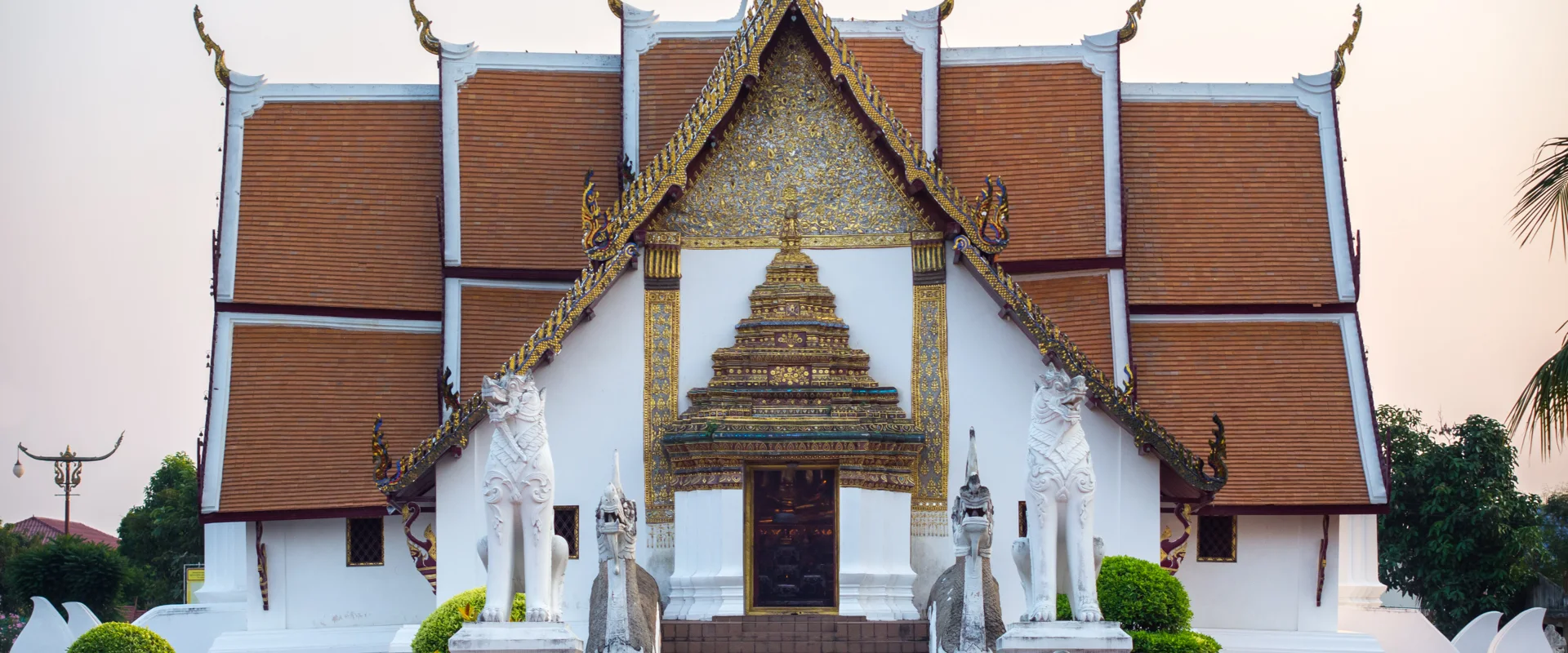
Use Mueang Nan as the cultural base for Wat Phumin and its celebrated murals, Nan National Museum, Wat Phra That Khao Noi and nearby Wat Phra That Chae Haeng. Pua is a useful northern base for Tai Lue culture, rice-field scenery and access toward Doi Phu Kha National Park. Bo Kluea is known for its mountain salt tradition and sits on scenic but winding highland roads. In the south, Na Noi provides access toward Sao Din Na Noi and Si Nan National Park, including Doi Samer Dao. Distances can look short on a map but mountain journeys take time.
Nan covers 11,472.07 square kilometres. At 31 December 2024 it had 15 districts, 99 subdistricts and 895 villages. Its registered population was 470,507 in 2024; this is the province-wide civil-registration count, not the population of Nan city and not a visitor estimate. Nan Nakhon Airport is the most direct public-transport gateway. There is no railway station in the province, so onward travel depends on road transport; for rural districts, confirm local transfers, allow daylight for winding routes and check fuel and weather conditions before longer drives.
November to February generally offers cooler, drier weather for city exploration and mountain viewpoints, with cold nights possible at elevation. March to mid-May is hot, and rain usually increases from around mid-May to October; heavy rain can affect mountain roads, trails and visibility. Check current national-park notices, weather and air-quality information, dress respectfully at temples, avoid disturbing wildlife and village life, and do not assume viewpoints, campsites or remote roads are open without confirmation.
- Last reviewed
- 20 September 2026
- Content owner
- Thailand Navigator Editorial Team
- Page type
- Province guide