
Province guide
Pattani
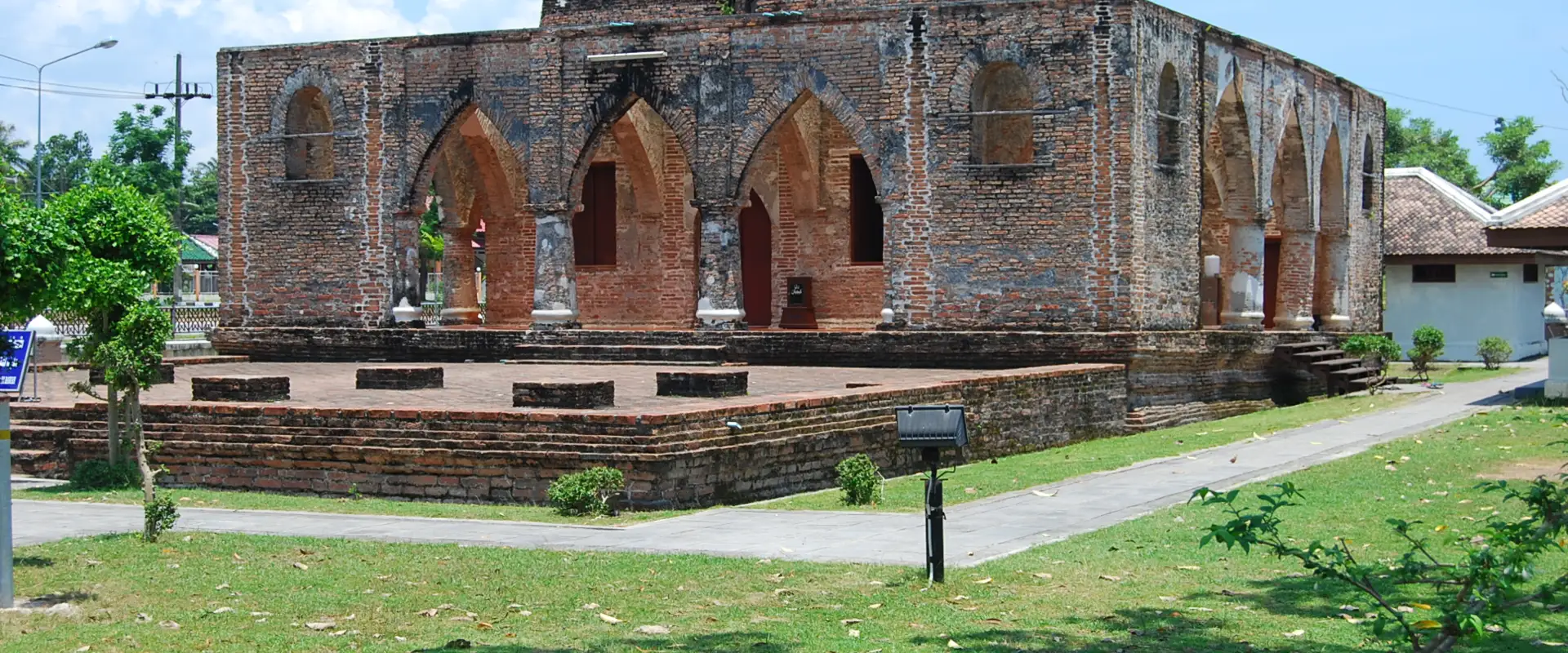
Pattani is a lower-southern Gulf province known for Malay Muslim, Thai Buddhist and Chinese heritage, historic religious sites, river communities and a long coastline.
Official source · National Statistical Office of ThailandUnderstand the areas
Explore the areas within Pattani and find a place for your visit or everyday life.
The interactive map loads as it comes into view.
Open full map →Kapho DistrictKapho District is an administrative district (amphoe) in Pattani Province, Thailand.Khok Pho DistrictKhok Pho District is an administrative district (amphoe) in Pattani Province, Thailand.Mae Lan DistrictMae Lan District is an administrative district (amphoe) in Pattani Province, Thailand.Mai Kaen DistrictMai Kaen District is an administrative district (amphoe) in Pattani Province, Thailand.Explore the geographic hierarchy →
Places by type





Explore Pattani
Browse places by type and discover what to see and do in Pattani.
History & culture
Explore Thailand’s rich history through ancient ruins, landmarks and monuments.
Explore places (0) →Religious sites
Visit Buddhist temples, shrines, churches and mosques across Thailand.
Explore places (0) →Nature & scenery
Discover beaches, islands, waterfalls, caves and breathtaking viewpoints.
Explore places (0) →Parks & outdoors
Explore national parks, trails, gardens and incredible wildlife.
Explore places (0) →Public spaces
Find vibrant squares, bridges and iconic public places.
Explore places (0) →Transport
Find airports, railway stations, bus and ferry terminals across Thailand.
Explore places (0) →Local categories
Things to do
Browse local businesses and services by type.
Local categories will appear as connected listings are published.
Browse every category in Pattani →
Find a business or service in Pattani
Search published businesses and services in this area.
Businesses in Pattani
View more businesses →No connected businesses are published yet.
Living in Pattani
Explore neighbourhoods, everyday services and practical information for a longer stay.
Choose an area to learn about living in Pattani
Each area has its own character. Follow the local guides to learn more.
Kapho District
Kapho District is an administrative district (amphoe) in Pattani Province, Thailand.
Khok Pho District
Khok Pho District is an administrative district (amphoe) in Pattani Province, Thailand.
Mae Lan District
Mae Lan District is an administrative district (amphoe) in Pattani Province, Thailand.
Mai Kaen District
Mai Kaen District is an administrative district (amphoe) in Pattani Province, Thailand.
Compare selected areas
Everyday essentials
HealthcareHospitals, clinics and medical services.Explore →
Schools & familyEducation and everyday family life.Explore →
Shopping & marketsLocal shops, markets and essentials.Explore →
Getting aroundLocal transport, taxis and vehicle hire.Explore →
Working remotelyCoworking and professional services.Explore →
More ways to use Pattani
Plan the practical details
Find transport options and useful information for visiting Pattani.
Getting to Pattani
Explore routes and transport connections. Check current schedules and availability before travelling.



Getting around Pattani
Find local transport services and practical guidance.

Essential travel information
Weather in Pattani
Check current weather, flood information and official travel advice before planning; conditions are more important than a fixed season.
Loading current conditions and forecast…
Nearby destinations
Explore more places and local guides.
Sakho Tai Subdistrict
Sakho Tai is a four-village subdistrict of Mayo, separately identified within the shared Sakho Bon council area. · 1.0 km away
Kraso Subdistrict
Kraso is a lowland farming subdistrict of Mayo, with Khlong Ra Ko, irrigation channels and connections to Highway 4061. · 2.3 km away
Sakho Bon Subdistrict
Sakho Bon is a three-village Mayo subdistrict within a council area shared with neighbouring Sakho Tai. · 2.5 km away
Pulakong Subdistrict
Pulakong is an inland Yaring subdistrict with several village communities, distinct from the neighbouring tambon of Talo. · 3.1 km away
About Pattani
Pattani is a compact Gulf of Thailand province in the lower south, with a long coastline, the Pattani and Sai Buri river systems, fishing and farming communities, and a distinctive cultural landscape shaped by Malay Muslim, Thai Buddhist and Chinese heritage. It is a separate first-order administrative division with twelve districts; Pattani city is the provincial capital.
Mueang Pattani brings together the Central Mosque, riverfront city life and Lim Ko Niao Shrine, while Krue Se Mosque and nearby historic sites reflect the area's long regional importance. Yarang contains remains associated with an earlier urban and trading centre. Official tourism information also highlights the coast, including Talo Kapo and Laem Tachi, and communities extending east through Yaring, Panare, Sai Buri and Mai Kaen. Use the district pages for local detail rather than attaching individual attractions directly to the province.
Road travel is the main way to move between districts. Pattani railway station is in Khok Pho District on the Southern Line rather than in the city centre, so allow for a road transfer; verify current train times and local transport before setting out. Airports and major transport hubs in the wider lower-south region may require substantial onward travel. Confirm exact destinations, avoid assuming that province and city names refer to the same point, and arrange reliable transport for rural or coastal stops.
Pattani is warm and humid year-round, and Gulf-coast rain can be heavy, particularly during the northeast-monsoon period; check the Thai Meteorological Department forecast and local flood information. Security conditions can change. As reviewed on 21 September 2026, the UK Foreign, Commonwealth and Development Office advises against all but essential travel to Pattani Province. Travellers should check their own government's current advice, understand insurance implications, follow local-authority instructions and reconsider plans if conditions are uncertain. Dress respectfully at mosques, temples and shrines, ask before photographing people, and verify opening arrangements directly.
- Last reviewed
- 20 September 2026
- Content owner
- Thailand Navigator Editorial Team
- Page type
- Province guide