

Province guide
Phang Nga
Phang Nga is an Andaman province of limestone bay scenery, Khao Lak beaches, mangroves, historic Takua Pa and protected island groups including the Similan and Surin Islands.
Official source · National Statistical Office of ThailandUnderstand the areas
Explore the areas within Phang Nga and find a place for your visit or everyday life.
The interactive map loads as it comes into view.
Open full map →Kapong DistrictKapong District is an administrative district (amphoe) in Phangnga Province, Thailand.Khura Buri DistrictKhura Buri District is an administrative district (amphoe) in Phangnga Province, Thailand.Ko Yao DistrictKo Yao District is an administrative district (amphoe) in Phangnga Province, Thailand.Mueang Phang-Nga DistrictMueang Phang-Nga District is an administrative district (amphoe) in Phangnga Province, Thailand.Explore the geographic hierarchy →
Places by type

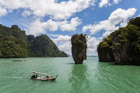



Explore Phang Nga
Browse places by type and discover what to see and do in Phang Nga.
History & culture
Explore Thailand’s rich history through ancient ruins, landmarks and monuments.
Explore places (0) →Religious sites
Visit Buddhist temples, shrines, churches and mosques across Thailand.
Explore places (0) →Nature & scenery
Discover beaches, islands, waterfalls, caves and breathtaking viewpoints.
Explore places (12) →Parks & outdoors
Explore national parks, trails, gardens and incredible wildlife.
Explore places (0) →Public spaces
Find vibrant squares, bridges and iconic public places.
Explore places (0) →Transport
Find airports, railway stations, bus and ferry terminals across Thailand.
Explore places (0) →Local categories
Things to do
Browse local businesses and services by type.
Local categories will appear as connected listings are published.
Browse every category in Phang Nga →
Find a business or service in Phang Nga
Search published businesses and services in this area.
Businesses in Phang Nga
View more businesses →No connected businesses are published yet.
Living in Phang Nga
Explore neighbourhoods, everyday services and practical information for a longer stay.

Choose an area to learn about living in Phang Nga
Each area has its own character. Follow the local guides to learn more.
Kapong District
Kapong District is an administrative district (amphoe) in Phangnga Province, Thailand.
Khura Buri District
Khura Buri District is an administrative district (amphoe) in Phangnga Province, Thailand.
Ko Yao District
Ko Yao District is an administrative district (amphoe) in Phangnga Province, Thailand.
Mueang Phang-Nga District
Mueang Phang-Nga District is an administrative district (amphoe) in Phangnga Province, Thailand.
Compare selected areas
Everyday essentials
HealthcareHospitals, clinics and medical services.Explore →
Schools & familyEducation and everyday family life.Explore →
Shopping & marketsLocal shops, markets and essentials.Explore →
Getting aroundLocal transport, taxis and vehicle hire.Explore →
Working remotelyCoworking and professional services.Explore →
More ways to use Phang Nga
Plan the practical details
Find transport options and useful information for visiting Phang Nga.
Getting to Phang Nga
Explore routes and transport connections. Check current schedules and availability before travelling.



Getting around Phang Nga
Find local transport services and practical guidance.

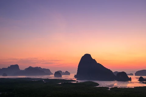
Essential travel information
Weather in Phang Nga
November to April generally has more settled Andaman conditions; check marine forecasts and national-park opening notices.
Loading current conditions and forecast…
Nearby destinations
Explore more places and local guides.
Tha Na Subdistrict
Tha Na is a Kapong subdistrict with village communities, local civic services and river-valley connections. · 4.0 km away
Kapong District
Kapong District is an administrative district (amphoe) in Phangnga Province, Thailand. · 5.8 km away
Tamtua Subdistrict
Tamtua is an inland Takua Pa subdistrict with six villages, steep outer slopes and a central river plain. · 7.1 km away
Mo Subdistrict
Mo is a Kapong subdistrict with agricultural villages, community-forest connections and Kapong Chai Phat Hospital. · 7.2 km away
About Phang Nga
Phang Nga is an Andaman-coast province of forested limestone mountains, mangroves, beaches and offshore islands. Phang Nga Bay forms its dramatic southern seascape, while the mainland runs north through Khao Lak and Takua Pa towards Khura Buri. The province is a first-order administrative division with eight districts; its populated islands and protected marine groups add a second geographic layer beyond the district structure.
Mueang Phang-Nga and Takua Thung are practical for Phang Nga Bay, limestone scenery and Ko Panyi. Thai Mueang and Takua Pa cover much of the Khao Lak coast and provide access to beaches, waterfalls and the historic quarter of Takua Pa. Ko Yao Noi and Ko Yao Yai offer a slower island base within the bay, while Khura Buri is the principal mainland gateway for the Surin Islands. The Similan Islands and Surin Islands are protected marine destinations with access controlled by national-park rules; use their child pages and the district pages for local detail.
There is no scheduled commercial airport in the province. Phuket and Krabi are common air gateways, followed by road transfer; journey time varies widely because Phang Nga stretches along the coast. Buses and vans connect mainland centres, but boats, piers and transfer arrangements differ by island and season. Confirm the exact pier, operator, baggage limits and return service before departure, and do not assume that a Phang Nga Bay tour reaches the Similan or Surin groups.
November to April usually brings more settled Andaman conditions, while the southwest monsoon from roughly May to October can bring heavy rain, rough seas and cancellations. Newer Department of National Parks notices give the Similan visitor season as 15 October to 15 May, and confirm that the 2026 season opened on 15 October. These notices supersede the older booking-page schedule; access can still change for weather or conservation. Check park notices and marine forecasts, use licensed operators, wear life jackets, avoid touching coral or wildlife, carry reef-conscious sun protection and leave extra time for weather-related changes.
- Last reviewed
- 25 October 2026
- Content owner
- Thailand Navigator Editorial Team
- Page type
- Province guide