
Province guide
Phetchabun
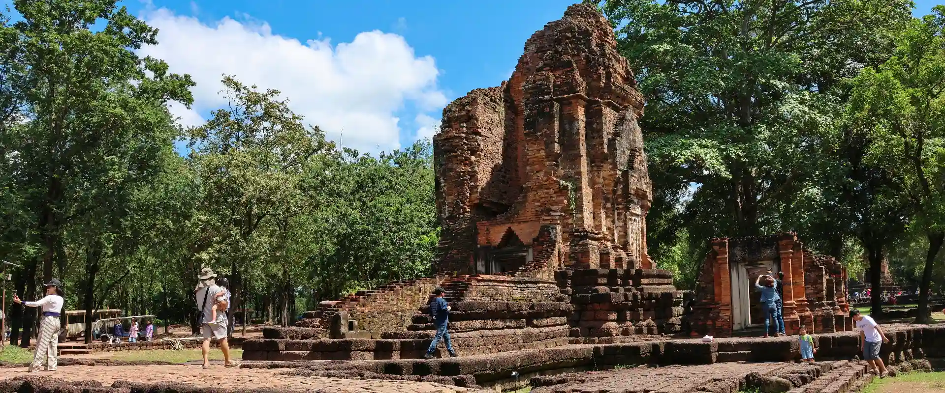
Phetchabun spans mountain retreats around Khao Kho and Phu Thap Boek, the provincial town and the UNESCO-listed Dvaravati heritage of Si Thep.
Official source · Tourism Authority of Thailand: PhetchabunUnderstand the areas
Explore the areas within Phetchabun and find a place for your visit or everyday life.
The interactive map loads as it comes into view.
Open full map →Bueng Sam Phan DistrictBueng Sam Phan District is an administrative district (amphoe) in Phetchabun Province, Thailand.Chon Daen DistrictChon Daen District is an administrative district (amphoe) in Phetchabun Province, Thailand.Khao Kho DistrictKhao Kho District is an administrative district (amphoe) in Phetchabun Province, Thailand.Lom Kao DistrictLom Kao District is an administrative district (amphoe) in Phetchabun Province, Thailand.Explore the geographic hierarchy →
Places by type





Explore Phetchabun
Browse places by type and discover what to see and do in Phetchabun.
History & culture
Explore Thailand’s rich history through ancient ruins, landmarks and monuments.
Explore places (0) →Religious sites
Visit Buddhist temples, shrines, churches and mosques across Thailand.
Explore places (0) →Nature & scenery
Discover beaches, islands, waterfalls, caves and breathtaking viewpoints.
Explore places (0) →Parks & outdoors
Explore national parks, trails, gardens and incredible wildlife.
Explore places (0) →Public spaces
Find vibrant squares, bridges and iconic public places.
Explore places (0) →Transport
Find airports, railway stations, bus and ferry terminals across Thailand.
Explore places (0) →Local categories
Things to do
Browse local businesses and services by type.
Local categories will appear as connected listings are published.
Browse every category in Phetchabun →
Find a business or service in Phetchabun
Search published businesses and services in this area.
Businesses in Phetchabun
View more businesses →No connected businesses are published yet.
Living in Phetchabun
Explore neighbourhoods, everyday services and practical information for a longer stay.
Choose an area to learn about living in Phetchabun
Each area has its own character. Follow the local guides to learn more.
Bueng Sam Phan District
Bueng Sam Phan District is an administrative district (amphoe) in Phetchabun Province, Thailand.
Chon Daen District
Chon Daen District is an administrative district (amphoe) in Phetchabun Province, Thailand.
Khao Kho District
Khao Kho District is an administrative district (amphoe) in Phetchabun Province, Thailand.
Lom Kao District
Lom Kao District is an administrative district (amphoe) in Phetchabun Province, Thailand.
Compare selected areas
Everyday essentials
HealthcareHospitals, clinics and medical services.Explore →
Schools & familyEducation and everyday family life.Explore →
Shopping & marketsLocal shops, markets and essentials.Explore →
Getting aroundLocal transport, taxis and vehicle hire.Explore →
Working remotelyCoworking and professional services.Explore →
More ways to use Phetchabun
Plan the practical details
Find transport options and useful information for visiting Phetchabun.
Getting to Phetchabun
Explore routes and transport connections. Check current schedules and availability before travelling.



Getting around Phetchabun
Find local transport services and practical guidance.

Essential travel information
Weather in Phetchabun
November to February generally offers cooler conditions for outdoor visits. The hotter period and the rains bring different travel considerations, with rain usually increasing from around May to October; check current forecasts for your route.
Loading current conditions and forecast…
Nearby destinations
Explore more places and local guides.
Wang Chomphu Subdistrict
Wang Chomphu Subdistrict is an official tambon in Mueang Phetchabun District, Phetchabun, Thailand. · 1.8 km away
Huai Sakae Subdistrict
Huai Sakae Subdistrict is an official tambon in Mueang Phetchabun District, Phetchabun, Thailand. · 7.5 km away
Ban Tok Subdistrict
Ban Tok Subdistrict is an official tambon in Mueang Phetchabun District, Phetchabun, Thailand. · 11 km away
Huai Pong Subdistrict
Huai Pong Subdistrict is an official tambon in Nong Phai District, Phetchabun, Thailand. · 12 km away
About Phetchabun
Phetchabun is a province of mountain ranges and settled valleys with several distinct visitor areas. Khao Kho and Phu Thap Boek attract people seeking highland scenery, while the provincial town and the southern Si Thep area offer different cultural and historical experiences.
Wat Phra That Pha Son Kaew and Khao Kho viewpoints are notable highland stops. Nam Nao and Thung Salaeng Luang provide protected natural landscapes with activities subject to park rules. In the south, the Ancient Town of Si Thep and its associated Dvaravati monuments form a UNESCO World Heritage property, inscribed in 2023; it should be planned as a separate archaeological visit rather than an incidental stop on a mountain loop.
Group your itinerary geographically. Highland roads, the town and Si Thep involve substantial onward travel, and a province-wide route needs realistic driving time. Confirm which park entrance or historical-site component you intend to reach. Cool mornings and mist are possible on higher ground, but visibility varies. Check forecasts and park access, use marked trails and keep clear of fragile archaeological structures.
Phetchabun Province covers 12,668.42 square kilometres and had 11 districts, 117 subdistricts and 1440 villages at 31 December 2024. Its 2024 registered population was 960,718; this is a whole-province civil-registration count, distinct from the capital city or an estimate of visitors.
November to February generally offers cooler conditions for outdoor visits. The hotter period and the rains bring different travel considerations, with rain usually increasing from around May to October; check current forecasts for your route.
- Last reviewed
- 25 October 2026
- Content owner
- Thailand Navigator Editorial Team
- Page type
- Province guide